Climb Cotopaxi Volcano in a guided group.
Ready to climb Cotopaxi volcano in Ecuador?
This small group guided group trekking and mountain climbing trip will give you the confidence and skills to climb this iconic peak, Cotopaxi.
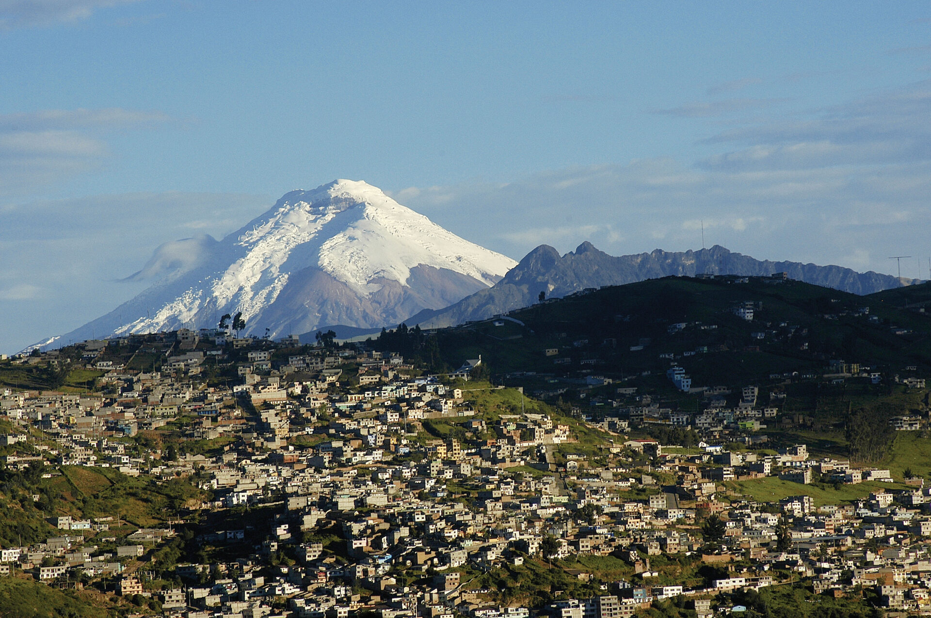
With its perfect, snow-capped conical peak, Cotopaxi is rightly considered one of the world’s most beautiful mountains. Adventure-hungry trekkers and climbers travel to scale this mighty volcano, whose summit lies at 5,897m/19,288ft.
Luckily, this mountain has more clear weather days than any other in the country. Certainly, the tour is planned to get you ready for the challenge of reaching the top of Cotopaxi.
More on climb Cotopaxi volcano.
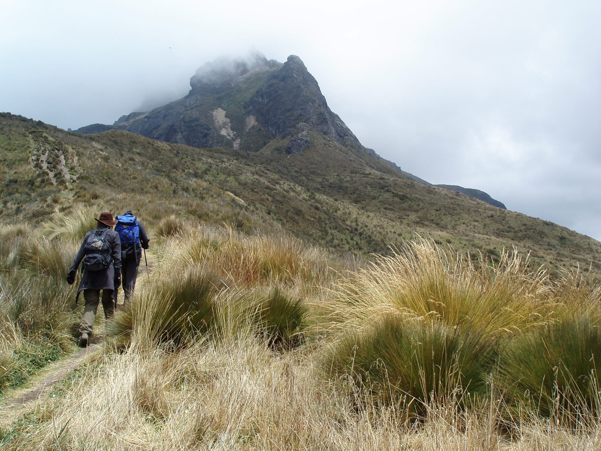
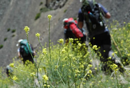
Before we climb Cotopaxi volcano, our expert guides will show you some of the beautiful parts of Ecuador, which skirt the mighty mountain. We’ll camp in the countryside as we warm up with acclimatisation hikes and lower-level volcanoes.
There are ancient shrines to see as well as cascading water falls and verdant forests replete with many bird species. As we tackle some of the lower peaks to accustom our bodies to the high altitude, we’ll stay in estancias and lodges full of character and steeped in climbing lore.
Glacier skills
We prepare for the final push to climb Cotopaxi volcano with a glacier skills review and technical briefing about the summit.
Fully prepped, the only thing that will stand between you and the top of Cotopaxi will be your determination (& may be the weather) to claim the peak of one of the world’s highest active volcanoes.
Trip Highlights
Print Share Download as PDF-
Climb Cotopaxi volcano
-
Beautiful approach to Cotopaxi National Park
-
Gradual acclimatisation process including two peaks
-
Camp and experience Ecuador’s rural life
-
Stay at estancias, lodges, and refugios steeped in climbing folklore
I had such a wonderful time in Ecuador, definitely an experience I will never forget. I'm really glad I included Pasachoa at the start to help with acclimatisation.
It was so beautiful as well. All the info, help and assistance I received prior to booking and the actual booking of the trip was so easy it was awesome (thanks Kat).
S. McGregor, Ecuador climbing tour
Gallery
Videos
Full Itinerary
Day 1: Arrive Quito, transfer airport to hotel
You arrive into Quito, and are met on arrival and taken to your simple hotel either in the centre of Ecuador’s capital city or in a nearby valley.
Quito was declared a World Heritage Site in 1978 by UNESCO, and you can spend your free time exploring or just taking it easy as you get used to the altitude.
Day 2: Free day Quito, hotel (B)
A free day to settle into bustling Quito and acclimatise a little.
You can choose to explore this vibrant city and its well preserved colonial old town and nearby Equator line by yourself, or we can arrange a city tour for you, taking in the sites, museums, markets and churches.
Day 3: Hike to Hacienda Santa Rita, camp (B,L,D)
We leave Quito and drive for about an hour to Rumipamba, starting at a gentle 2,850m/ 9,350ft.
Our trek today follows the Pita River, which flows here all the way from Cotopaxi National Park. The path is cobbled stone and takes us past a local shrine, the “Virgen de la Piedra”, or the Virgin of the Rock, where people still worship.
Today aims to loosen the legs while acclimatising gently, enjoying a packed lunch on the way. The hike last between four and five hours and leads us to our campsite at Hacienda Santa Rita, situated at 3,280m/10,761 ft. You only carry a day pack.
Everything is set up at our camp, ready for our arrival, where you’ll be reunited with your main luggage, carried by our transport. Relax, soak in the surroundings, or a hot shower, and await a tasty dinner.
Hiking time: 4-5 hours
Starting elevation: 2,850m/9,350ft
Highest elevation: 3,280m/10,761ft
Day 4: Pasochoa Volcano hike, camp (B,Bl,D)
We wake early, aiming for an 8 am departure. Today’s target is Pasochoa volcano, whose peak sits at 4,200m/13,845ft. This eroded volcano has been inactive since the last ice age.
Walking to higher altitudes and sleeping at levels is an excellent way to acclimatise. We set off through the hacienda’s fields before climbing Pasochoa’s flanks.
Today is an up-and-down, A to B and back to A hike, lasting six to seven hours. We leave all our kit at the campsite with our cook and staff, so you again only carry a day pack.
Upon summiting, if the weather is clear, we can gaze into Pasochoa’s crater. This is a fantastic sight, it being the Pasochoa Protected Forest Reserve, a humid Andean forest. The crater’s altitude varies from 2,700m/8,858ft to 4,200m/13,845ft and is home to more than 110 bird species and 45 different species of trees.
Return to the camp for a hearty dinner and unwind after the day’s walk.
Hiking time: 6-7 hours
Starting elevation: 3,280m/10,761ft
Highest elevation: 4,200m/13,845ft
Day 5: Hike to Hacienda El Porvenir, lodge (B,L,D)
We wave goodbye to our campsite and use today’s walk to reposition ourselves for tomorrow’s second acclimatisation summit.
It’s a scenic and undulating walk, including a section of humid Andean forest where we may spot hummingbirds. Today represents another step in our adaptation to the high altitude by sleeping at a higher level.
Our destination es hacienda El Porvenir, a traditional Andean hacienda. El Porvenir sits at 3,600m/11,811ft, surrounded by the volcanoes Sincholahua, Pasochoa, Rumiñahui, and Cotopaxi.
Note: We’ll sleep at Los Mortiños hacienda if El Porvenir is unavailable.
Hiking time: 4-5 hours
Starting elevation: 3,280m/10,761ft
Highest elevation: 3,600m/11,811ft
Day 6: Hike Rumiñahui Volcano, lodge (B,L,D)
Our target today is the central summit of the Rumiñahui volcano. To get there, we use the transport vehicle to drive us to the nearby Limpiopungo lake.
In Quichua, Rumiñahui means ‘stone face’, and the volcano is named after the Inca Emperor’s general. Rumiñahui gained fame for leading Inca warriors against the Spanish conquistadores that had killed the emperor, Atahualpa.
The path may be a little loose underfoot, so care is needed on the ascent. We’re close to Cotopaxi, only some 7 miles/13km southeast of Rumiñahui.
Once we reach the top and appreciate the beautiful views, we descend and head to our next accommodation, the famous Tambopaxi Lodge. Here we meet back up with our main luggage, have carried just a day pack once more.
Hiking time: 5-6 hours
Starting elevation: 3,600m/11,811ft
Highest elevation: 4,600m/15,092ft
Day 7: Hike to Cotopaxi Glacier, lodge (B,L,D)
We hike high today, but not for too long, breaking the 5,000m mark, almost a reconnaissance mission for the Cotopaxi climb that awaits us.
We’ll drive up to the Cotopaxi refuge car park, then walk 45 minutes to the refuge itself. It’s here in the refuge we’ll sleep tomorrow night, dreaming of reaching the peak of Cotopaxi.
Passing the refuge, we’ll walk for an hour or so to reach Cotopaxi glacier. The sight of the ice will bring our mission into focus. We head back to the car park and drive to Tambopaxi Lodge.
Take advantage of the warm showers tonight — tomorrow night’s conditions will be more challenging.
Hiking time: 2-3 hours
Starting elevation: 3,720m/12,205ft
Highest elevation: 5,000m/16,404ft
Day 8: Glacier Skills, Cotopaxi Refuge (B,L,D)
Today begins the same as yesterday; driving from Tambopaxi Lodge to Cotopaxi car park. The only difference is that everyone needs to carry all their required kit from the car park to Cotopoaxi refuge, which sits at 4,810m/15,780ft. It should take us 45-60 minutes to complete the walk.
Lunch is taken at the refuge; then, we hike to the glacier. We review people’s glacier skills and provide a briefing about the technical aspects to expect on the ascent.
Note: Experience using crampons and ice axes for trekking in the snow is a bonus. However, no previous mountaineering skills are required. We may use ropes for belaying on some parts of the climb.
Revision complete, we return to the refuge for a hearty meal and catch as much sleep as possible before tomorrow’s final push. Climbing Cotopaxi will involve our most demanding day.
Hiking time: 1 hour, +2 hours glacier skills
Starting elevation: 3,720m/12,205ft
Highest elevation: 5,000m/16,404ft
Day 9: Cotopaxi Summit, Return to Quito, hotel (B,L)
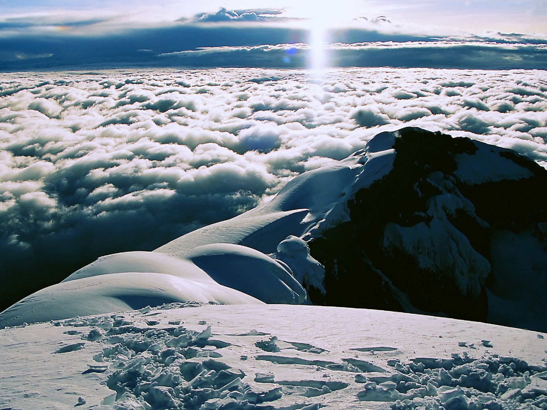
Today we climb Cotopaxi volcano (5,897m/19,347ft).
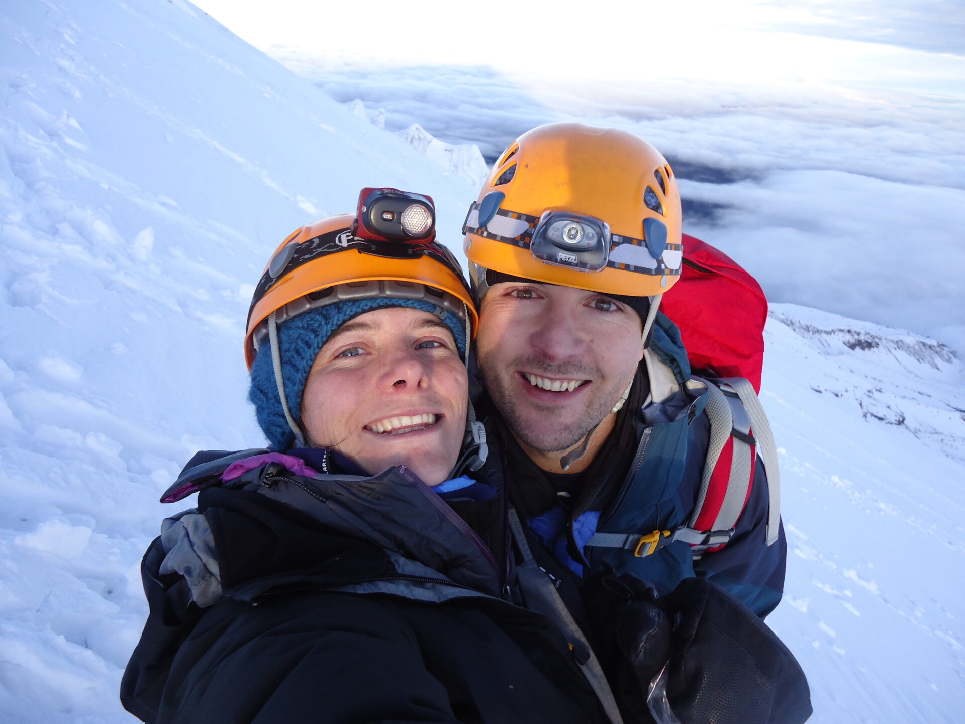
Set your alarms early because we set off around one in the morning. Ahead of us awaits a six-hour climb along Cotopaxi’s flanks.
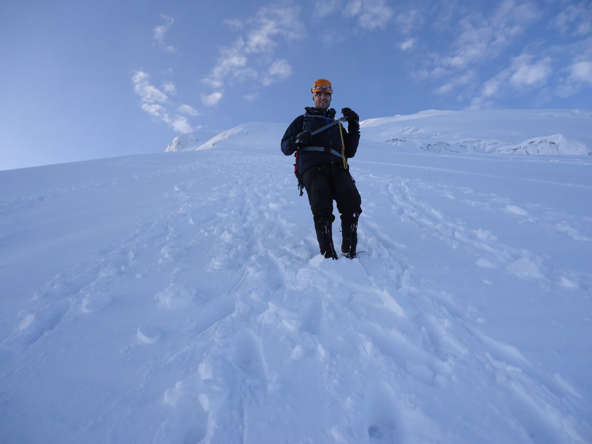
Moderate glacial slopes will give way to crevasses and snow bridges, making for exciting climbing. The crevasses continue for some time, getting more intense as we reach the final section. While the ascent is not considered overly technical, our guides take the greatest care to treat all the crevasses with respect.
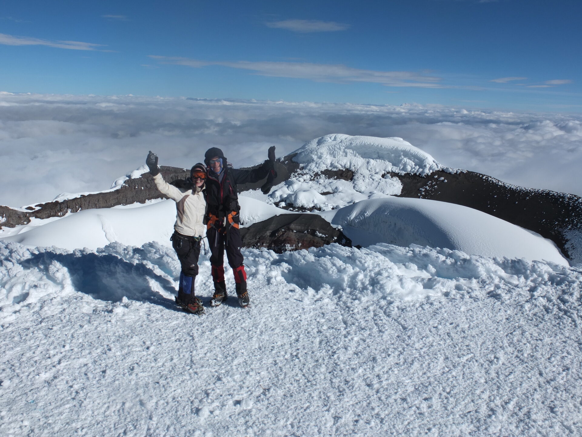
The summit lies behind a challenging 35-40 degree slab of snow, which we must ascend to reach the crater and summit. The climb may seem to end abruptly as we suddenly crest and grab the peak of one of the world’s highest active volcanoes.
Peek inside the crater, which measures almost a kilometre in diameter, to see sulphuric fumaroles or gaze out over the mesmeric views below Cotopaxi.
With the summit bagged, it takes only two or three hours to retrace our steps, the extra oxygen in the air giving us additional power. We’ll rest and regather our strength at the refuge before packing all our belongings into the transport and driving back to your Quito hotel.
Hiking time: 8-9 hours
Starting elevation: 4,810m/15,780ft
Highest elevation: 5,897m/19,347ft
Day 10: Transfer out, tour ends (B)
You will be picked up from you hotel for transfer to the airport. Tour ends (B)
Prices From $1,939 / £1,576 per person
What's Included?
Transfers, food and accommodation as listed, fully-equipped campsite, permits and park fees, fully-qualified hiking guide, one qualified mountain guide per every two climbers on Cotopaxi, climbing gear (crampons, harness, ice axe, carabiners, and group gear such as ropes).
What's Not Included?
Flights (we can look for these), insurance, alcoholic drinks, tips, laundry, plastic mountaineering boots (available to rent), sleeping bag, thermarest/sleeping mat, rental fee for gas mask ($10) now required by the national park to be able to climb Cotopaxi due to the presence of sulphur.
Accommodation
We use a mix of campsites, estancias, haciendas, and climbing refuges on this trip. Please note that all are subject to availability and may be changed when necessary.
Camping
Our campsite, next to a river, will be set up for your arrival (you need to bring a sleeping bag and mat/thermarest). We have a dedicated chef to prepare your meals, a dining tent, and there is a toilet block with hot water showers.
Hacienda El Porvenir
El Porvenir is a traditional Andean hacienda with a thatched roof. The farmhouse was built with traditional local materials like straw, wood, and adobe, plus bricks. El Porvenir features log fires in the sitting rooms.
Rooms are more basic with woven walls separating the bedrooms. Bathrooms have hot showers in this clean and comfortable lodging.
Tambopaxi Lodge
Tambopaxi Lodge is the only hotel within Cotopaxi National Park, built in 2002 with incredible views to Cotopaxi volcano. Hot showers and plentiful food are found at this legendary lodge.
Tour Staff
We have worked for many years with our fully-qualified mountain guides.
They live for climbing in the area and know the mountains extremely well. They speak English and will show you all the techniques you need in order to make a safe and successful summit attempt.
We use the same local drivers and support staff we have used for many years – everyone involved has many years experience in the mountains.
Meals
Breakfasts will be a mix of hot drinks, cereals, fruit and toast with jams.
Boxed lunches, while out walking, will be either sandwiches or meat and cheese with crackers, with fruit etc available on trips from camps.
Evening meals at refuges are large and feature bread, vegetables, meats and hot drinks, rice and pasta dishes. Almost all dietary requirements can be catered for – please ask.
We have a cook who prepares meals at the campsites and the accommodation provides the food between days three and seven.
Activity Level
The trip is open to anyone with a positive attitude who wants to walk in a stunning and remote part of Ecuador’s Andes, and to really challenge themselves.
Ideally, we recommend acclimatising in Quito or an area of similar altitude for a few days before starting this trip — we can help with suggestions.
All group members need to have a very good level of fitness for the trip and be prepared for successive days of full-day hikes. A typical day involves around five to seven hours of walking, gaining between 500-1,000m/1,640-3,280ft of elevation.
No previous mountaineering skills are required. Ropes may be used to belay on some part of the climb.
Practical Information
Ecuador's volcanoes and acclimatisation peaks
Acclimatisation Peaks
These peaks are non-technical and are suitable for acclimatizing on prior to tackling one of Ecuador’s big volcanoes. We recommend several days in Quito and at least two peaks before doing our mountaineering course or attempting peaks over 5,000m/16,404ft.
Guagua Pichincha: 4,794m/15,728ft. An active volcano on the outskirts of Quito that last erupted in October 1999. This is a readily accessible and scenic acclimatisation climb that offers fabulous views from the crater’s rim.
Ruminahui: 4,634m/15,203ft. Named after Atahualpa’s general who led the fight against the Spanish conquistadors after Atahualpa was murdered. Legend has it that Ruminahui hid a large cache of the Inca ruler’s gold in an undisclosed, and still unknown, location. This climb is a good acclimatisation warm up climb in Cotopaxi National Park and offers magnificent views of Cotopaxi.
Imbabura: 4,630m/15,190ft. The peak overlooking Otavalo. It is a long walk up, with a short scramble near the summit. The summit ridge offers great views of Imbabura’s impressive open crater and Lago San Pablo.
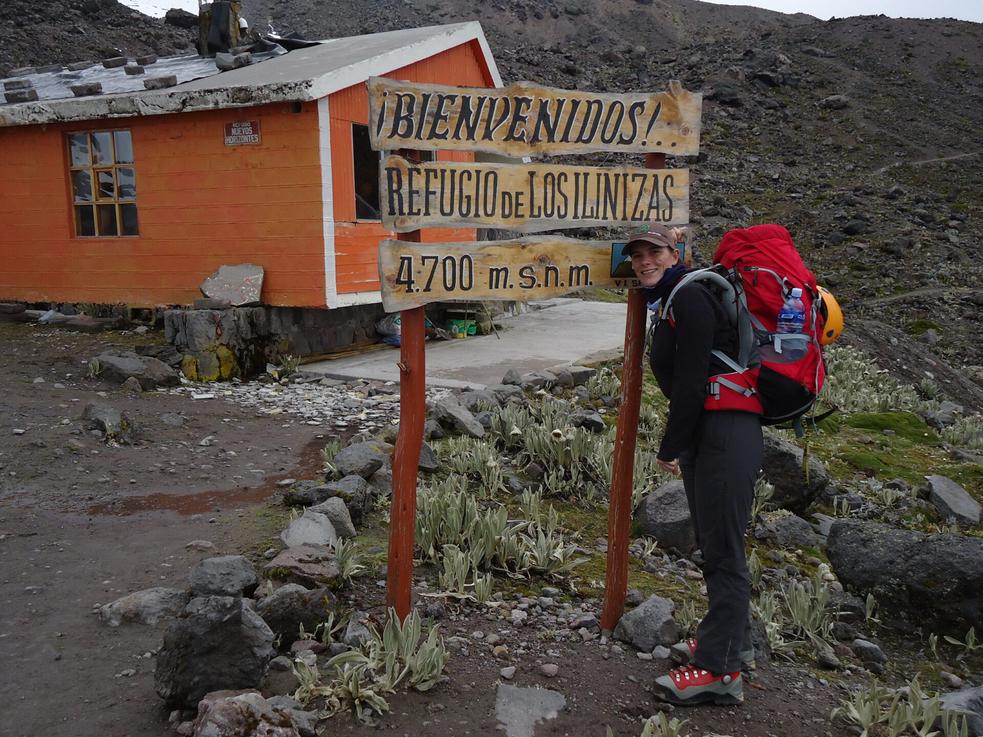
Illinizas Norte: 5,126m/16,818ft. An excellent acclimatisation peak with a bit of a scramble to reach the summit and magnificent views. Although it looks like a large pile of rock rubble, the rock is pretty good by Ecuadorian standards.
Pasachoa: 4,199m/13,776ft. An ancient, severely eroded volcano inactive since the last ice age. It is 30km south of Quito. There is a short scramble from the top of the grassy ridge to the summit.
Carihuayrazo: 5,100m/16,732ft. An ideal acclimatisation peak in conjunction with the Abraspungo trek. It is also a good place to practice basic glacier skills, use of crampons and ice-axe self arrest. Loose rock and scree to cross above the glacier and then a scramble to reach the summit.
Cubilche: 3,800m/12,467ft. Some 14km from Otavalo, a dormant volcano with five small craters on the top, an ideal acclimatisation peak.
Ecuador’s big volcanoes
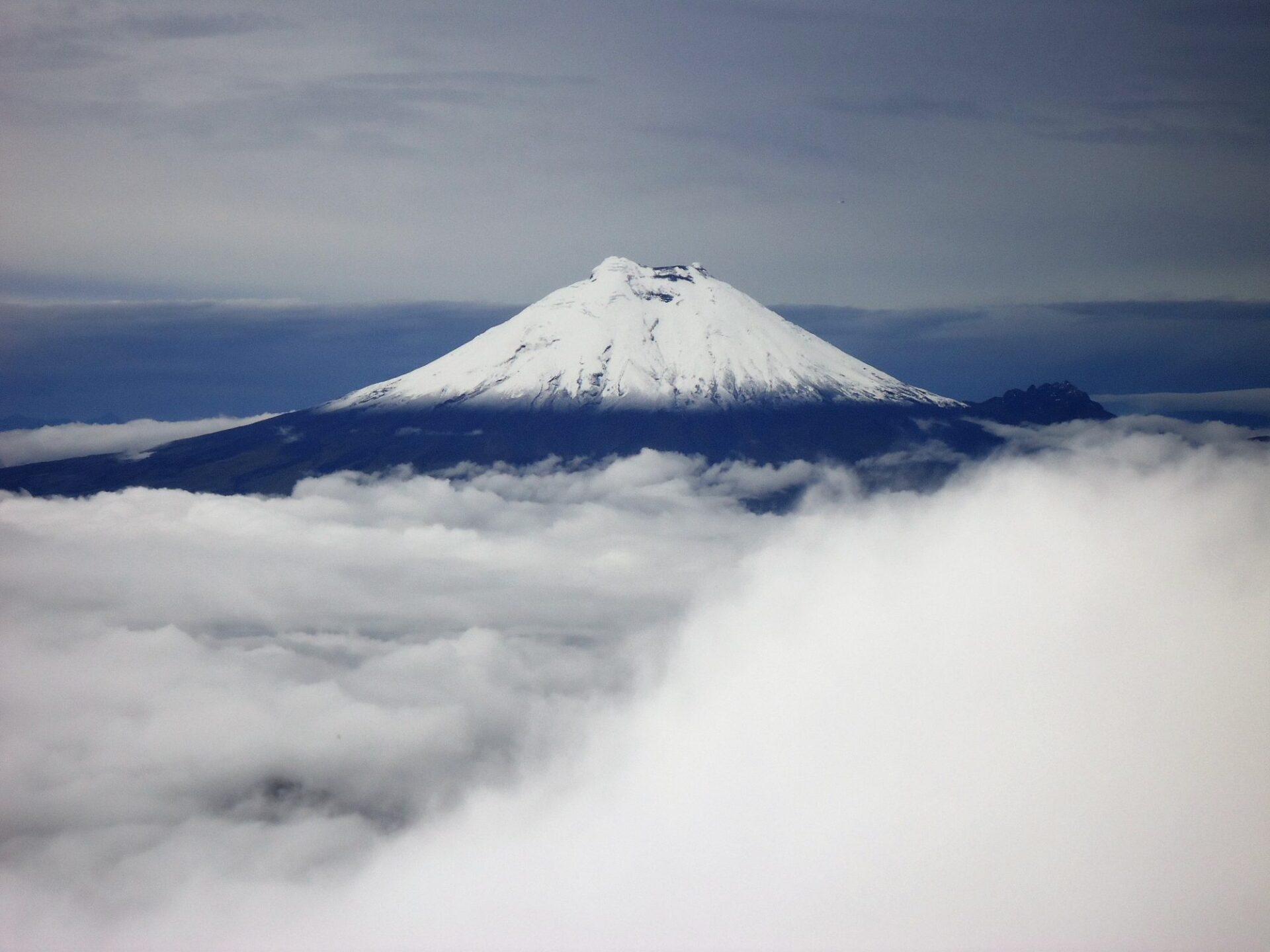
Cotopaxi: 5,897m/19.347ft. This is Ecuador’s second-highest peak and one of the highest active volcanoes in the world. It is a nearly perfect snow-capped volcanic cone, situated 55 kilometres south of Quito in Cotopaxi National Park. We drive to just below the refuge (4,800m/15,748ft) and from there it is a 6-8 hour climb to the summit, mostly on steep snow and ice slopes. First climbed in November 1872 by Angel Maria Escobar (Colombia) and Wilhelm Reiss (Germany). Currently active.
Cayambe: 5,790m/18,996ft. Thisis the highest and coldest point on the equator. It is the only place on earth where the latitude is zero degrees and so is the temperature. Long thought extinct, Cayambe is now deemed to be active and is closely monitored.
Chimborazo: 6,310m/20,702ft. This is Ecuador’s highest peak, and is one of the most impressive in all the Andes. Measured from the centre of the earth it is the highest mountain in the world. Chimborazo is the southern-most peak in the Cordillera Occidental chain of mountains. It was first climbed in 1880 by Jean Antoine and Louis Carrel (Italy) and Edward Whymper (UK). Best time for climbing is during late January and early February.
Antisana: 5,758m/18,891ft. This is big, high and covered in crevasses. This peak is also wild and remote, offering some of the most interesting climbing in Ecuador. Climbing Antisana is serious business and is as technically difficult as Cayambe. This peak has seen relatively few ascents.
Illinizas Sur: 5,263m/17,267ft. This peak is a technical climb – a steep route requiring use of crampons and ice axe as well as knowledge of self-arrest and glacier travel and crevasse rescue skills. The route is suffering from glacial retreat.
Introduction to Ecuador
Ecuador is the second smallest South American country, and one of the most varied.
It comprises three main geographical areas: the coast, highlands and Amazon plus is home to the Galapagos Islands.
Because of its relatively compact size, it makes a great holiday destination as you can move from highlight to highlight fairly easily and rapidly.
Weather in Ecuador
Ecuador lies between latitudes 4º south and 2º north. Overall, climate varies according to time of year, altitude and region.
The Sierra
In the Ecuadorian highlands, there is little temperature variation by season as temperature depends largely on altitude.
In Quito, shade temperatures range from 6 to 10ºC in the morning and from 19 to 23ºC in the afternoon, with cool nights. In the lower basins between mountains, it gets significantly warmer.
Rainfall depends on whether an area lies closer to the eastern or western Andes. To the west, June-Sept is the dry period and Oct-May the wet (with often a short, dry spell in Dec or Jan).
The best period to visit Quito and trek and climb volcanoes such as Cotopaxi is the west Andean dry season of June-Sept and Dec/Jan. This is also Ecuador’s high season. During the Oct-May wet season, most rainfall is in the afternoons.
To the east, Oct to Feb are dry and Mar-Sept are wet. Overall, the southern highlands are drier than the northern highlands.
The Coast
On the Pacific coast, rainfall becomes less from north to south. The coast can be enjoyed year-round, although from June-Sept mornings are often grey with the garua mists.
Jan-May is the hottest and rainiest time of year.
The Amazon
In Ecuador’s Amazonian region, rain can fall at any time, but Dec-March is usually the driest season and Mar-Sept is usually the wettest period.
The Galapagos Islands
Galapagos can be visited at any time of year.
The warm season is Jan-Jun, bringing calm, warm waters (around 70°F) and sunny days (72-9°F or 22-32°C), February and March being the hottest and sunniest months with blue skies and sunshine.
The islands receive slightly more rainfall during these months, occasional heavy bursts in the afternoon. Great for snorkelling and you can spend a lot of time in the water without wetsuits, with great, clear waters.
The dry ‘garua’ season is Jun-Dec an it’s a great time for marine life. August and September are the coolest when you may need a jacket in the evenings and the sea can be choppy and temperature drops around 15-24ºC on average.
There can be mist on the islands in the mornings (garua) which usually burns off by midday leaving overcast skies or a sunny afternoon.
Sea temperatures may drop to 60°F- 72°F (15-22°C) during this time and snorkellers will want a wet suit for prolonged periods in the sea.
Altitude
Being at altitude, especially in the tropics, is usually a pleasure as it isn’t so hot, there are few insects and the air is clear.
However, when gaining altitude, air pressure drops and the amount of oxygen reaching the lungs is reduced. Although we build plenty of acclimatisation time into our itineraries, certain ill-effects are possible. Nevertheless, all of these can be minimised or prevented if care is taken.
On reaching heights above 2,500m (approx. 8,200 ft), especially when ascent has been straight from sea level, heart pounding, mild headache and shortness of breath are normal, especially on exertion.
Acute mountain sickness (AMS) is a syndrome known locally as soroche, whose symptoms can include of bad headache, dizziness and nausea).
To avoid AMS, you should:
- Rest for a few hours on arrival at altitude and take it easy for the first couple of days. Note: you may feel fine on arrival and tempted to exert yourself as normal. Don’t be fooled: you might be benefiting from oxygen brought in your blood from sea level.
- Drink plenty of water to avoid dehydration (altitude is a diuretic). Coca tea (mate de coca) helps alleviate symptoms.
- Eat light meals, with high carbohydrate and low fat and protein content. Dine early, allowing digestion time pre-sleep.
- Avoid over-exposure to the strong highland sun (UV rays are very powerful) – especially in the early stages – making sure you wear a broad brimmed sunhat. Apply lip-salve to prevent chapped lips.
- Avoid or minimise consumption of cigarettes and alcohol. Avoid sleeping pills.
- If you do get AMS: Rest, take non-aspirin painkillers (for headache) and coca tea. Symptoms should subside after a day or two.
- Pregnant women, people with a history of heart, lung, kidney or blood disease or blood pressure problems, should consult their doctor before traveling to high altitude.
Kit list
Good kit is vital for every trip.
Book with Andean Trails and get 15% off Páramo’s fantastic ethical and high performance outdoor gear.
When planning for the extreme climatic conditions encountered on high peaks in the Andes, layering is the most practical and versatile clothing system. It’s worth remembering that our clothing keeps us warm by retaining and isolating the heat we ourselves create.
To best maintain body heat, several layers of lightweight, warm and quick-drying clothing are far more efficient than one or two thick layers.
Layers should have the following qualities:
- Breathability (able to wick away the humidity produced by sweat);
- Isolation (able to keep in the warm air our body produces); and
- Impermeability (able to impede the passing of wind and water).
First (base) layer: This layer wicks the sweat away from our skin, thus helping keep the body dry and warm. To this end, synthetic fabrics such as polypropylene should be used.
Mid layers: These isolating layers should also be synthetic (e.g. the known polar linings such as polartec or windblock, which are light and insulate twice as well as wool). Very important layers for retaining body heat.
Outer layer / shell: Finally, the vital layer which protects us from climatic adversities. A breathable, wind-proof and waterproof anorak, such as Goretex.
Note that it’s our extremities that stand to suffer the most, and on high Andean peaks the poorly-equipped mountaineer is at risk of becoming frostbitten. Hence, much thought should be given to deciding how best to protect hands, feet and head.
Give plenty of thought to kit selection, and try to keep weight down.
Below is a more detailed guide.
Feet
- 2 pairs synthetic inner socks (e.g. polypropylene, thermastat, coolmax)
- 2 pairs thick loop-stitch/wool socks for cold.
- Trekking boots – should be well broken-in, waterproof and provide good ankle support. Given the extreme cold, plastic mountaineering boots (e.g. Koflach) are also required. These are indispensable. (see ‘TECHNICAL KIT’ below)
- Gaiters (1 pair), heavy and large enough to fit over plastic boots.
- Trainers/sandals, for city-wear, evenings at lower camps & river crossings.
Legs
- Base layer leggings (1-2 pair).
- Thick fleece leggings (or salopettes) (1 pair).
- Goretex-type over-trousers (or salopettes) (1 pair).
- Trekking trousers (1 pair).
- Shorts – wear sparingly in early stages at altitude, as sun burns.
Body
- Thermal base layer shirts (2).
- Microfleece mid-layer shirt (1).
- Shirt/T-shirt 1 or 2 for lower altitudes. Long-sleeved, collared shirt protects against sun.
- Fleece jacket or similar (1).
- Warm jacket (down or synthetic) with hood. For camp and upper slopes.
- Waterproof Goretex-type jacket.
- 1-2 sports bras/tanks (for women)
Head and neck
- Broad-brimmed sunhat, essential.
- Warm hat, fleece or wool. (N.B. Up to 30% of body heat can be lost through the head).
- Balaclava/full-face ski mask (1)
- Sunglasses with UV filter and nose and side-pieces.
- 1 pair of glacier compatible sunglasses (full coverage – ask salesperson if you are not sure)
- Scarf for cold.
- Bandanna – to protect neck from strong sun.
- 1 cap with visor
Hands
For the extreme cold, we recommend a 3-layer scheme:
- 1 pair of Gore-Tex shell gloves
- 2 pairs of removable fleece glove liners
- Mittens allow you to keep the fingers together, and better conserve heat (though they also make it difficult to perform certain tasks).
Technical kit
- Large backpack (50-90 litres). Comfortable and with waterproof lining or cover.
- You will need another bag (duffel) which big pack fits into, with a zipper and lock.
- Daypack (at least 30 litres). Comfortable and with waterproof lining or cover.
- Plastic mountaineering boots (you can rent these)
- Crampons, strap-on or step-in (can be rented)
- Walking ice axe (can be rented)
- Pair of telescopic trekking poles. (can be rented).
Other expedition kit
- Sleeping bag – a good warm bag (‘4-season’, minimum) and liner will be necessary for high-altitude camping (comfortable to -10 degrees Celsius).
- Sleeping mat or thermarest.
- 2 x water bottles (2 litres each approx).
- Pee bottle.
- Personal first-aid kit to include: painkillers, plasters (band-aids), moleskin, anti-biotic cream, general antibiotics (ask your GP), after-bite (tiger balm), anti-diarrhoea tablets, throat lozenges, re-hydration salts & personal medication.
- Towel & wash-kit.
- Wet Wipes/antiseptic hand-wash cream.
- Sunscreen (factor 40+) and lip salve.
- Head-lamp (Plus spare bulbs and batteries x 2 at least).
- Penknife.
- Thermos flask (1 litre) Stainless steel.
- Alarm clock.
- Plastic bags ‘Zip-loc’ & tough bin liners.
- Camera and film / memory cards (take at least twice the amount you think you will need!).
- Book, e-book, mp3 player/iPod or other for free time.
- Binoculars.
- Spanish/English phrasebook.
- Extra snacks i.e. cereal bars or favourite chocolate bars.
All other non-personal trekking and camping equipment is provided, e.g. tents, cutlery etc.
Available Dates
31st Jul 2026 - From $1939 / £1576.407
Guide price, USD 1,939 per person based on four people or more in the group, shared tent/room basis.2 people: USD 2,238 per person / Shared tent/room basis
Single tent and room supplement USD 499
We can also run this tour at any time on a private basis
04th Sep 2026 - From $1939 / £1576.407
Guide price, USD 1,939 per person based on four people or more in the group, shared tent/room basis.2 people: USD 2,238 per person / Shared tent/room basis
Single tent and room supplement USD 499
We can also run this tour at any time on a private basis
16th Oct 2026 - From $1939 / £1576.407
Guide price, USD 1,939 per person based on four people or more in the group, shared tent/room basis.2 people: USD 2,238 per person / Shared tent/room basis
Single tent and room supplement USD 499
We can also run this tour at any time on a private basis
30th Oct 2026 - From $1939 / £1576.407
Guide price, USD 1,939 per person based on four people or more in the group, shared tent/room basis.2 people: USD 2,238 per person / Shared tent/room basis
Single tent and room supplement USD 499
We can also run this tour at any time on a private basis
13th Nov 2026 - From $1939 / £1576.407
Guide price, USD 1,939 per person based on four people or more in the group, shared tent/room basis.2 people: USD 2,238 per person / Shared tent/room basis
Single tent and room supplement USD 499
We can also run this tour at any time on a private basis
27th Nov 2026 - From $1939 / £1576.407
Guide price, USD 1,939 per person based on four people or more in the group, shared tent/room basis.2 people: USD 2,238 per person / Shared tent/room basis
Single tent and room supplement USD 499
We can also run this tour at any time on a private basis
11th Dec 2026 - From $1939 / £1576.407
Guide price, USD 1,939 per person based on four people or more in the group, shared tent/room basis.2 people: USD 2,238 per person / Shared tent/room basis
Single tent and room supplement USD 499
We can also run this tour at any time on a private basis
15th Jan 2027 - From $1939 / £1576.407
Guide price, USD 1,939 per person based on four people or more in the group, shared tent/room basis.2 people: USD 2,238 per person / Shared tent/room basis
Single tent and room supplement USD 499
We can also run this tour at any time on a private basis
05th Feb 2027 - From $1939 / £1576.407
Guide price, USD 1,939 per person based on four people or more in the group, shared tent/room basis.2 people: USD 2,238 per person / Shared tent/room basis
Single tent and room supplement USD 499
We can also run this tour at any time on a private basis
12th Feb 2027 - From $1939 / £1576.407
Guide price, USD 1,939 per person based on four people or more in the group, shared tent/room basis.2 people: USD 2,238 per person / Shared tent/room basis
Single tent and room supplement USD 499
We can also run this tour at any time on a private basis
05th Mar 2027 - From $1939 / £1576.407
Guide price, USD 1,939 per person based on four people or more in the group, shared tent/room basis.2 people: USD 2,238 per person / Shared tent/room basis
Single tent and room supplement USD 499
We can also run this tour at any time on a private basis
02nd Apr 2027 - From $1939 / £1576.407
Guide price, USD 1,939 per person based on four people or more in the group, shared tent/room basis.2 people: USD 2,238 per person / Shared tent/room basis
Single tent and room supplement USD 499
We can also run this tour at any time on a private basis
30th Apr 2027 - From $1939 / £1576.407
Guide price, USD 1,939 per person based on four people or more in the group, shared tent/room basis.2 people: USD 2,238 per person / Shared tent/room basis
Single tent and room supplement USD 499
We can also run this tour at any time on a private basis
25th Jun 2027 - From $1939 / £1576.407
Guide price, USD 1,939 per person based on four people or more in the group, shared tent/room basis.2 people: USD 2,238 per person / Shared tent/room basis
Single tent and room supplement USD 499
We can also run this tour at any time on a private basis
16th Jul 2027 - From $1939 / £1576.407
Guide price, USD 1,939 per person based on four people or more in the group, shared tent/room basis.2 people: USD 2,238 per person / Shared tent/room basis
Single tent and room supplement USD 499
We can also run this tour at any time on a private basis
30th Jul 2027 - From $1939 / £1576.407
Guide price, USD 1,939 per person based on four people or more in the group, shared tent/room basis.2 people: USD 2,238 per person / Shared tent/room basis
Single tent and room supplement USD 499
We can also run this tour at any time on a private basis
03rd Sep 2027 - From $1939 / £1576.407
Guide price, USD 1,939 per person based on four people or more in the group, shared tent/room basis.2 people: USD 2,238 per person / Shared tent/room basis
Single tent and room supplement USD 499
We can also run this tour at any time on a private basis
01st Oct 2027 - From $1939 / £1576.407
Guide price, USD 1,939 per person based on four people or more in the group, shared tent/room basis.2 people: USD 2,238 per person / Shared tent/room basis
Single tent and room supplement USD 499
We can also run this tour at any time on a private basis
12th Nov 2027 - From $1939 / £1576.407
Guide price, USD 1,939 per person based on four people or more in the group, shared tent/room basis.2 people: USD 2,238 per person / Shared tent/room basis
Single tent and room supplement USD 499
We can also run this tour at any time on a private basis
10th Dec 2027 - From $1939 / £1576.407
Guide price, USD 1,939 per person based on four people or more in the group, shared tent/room basis.2 people: USD 2,238 per person / Shared tent/room basis
Single tent and room supplement USD 499
We can also run this tour at any time on a private basis

Dates & Prices
Select an available date to view pricing and information for that particular trip.
Guide price, USD 1,939 per person based on four people or more in the group, shared tent/room basis.
2 people: USD 2,238 per person / Shared tent/room basis
Single tent and room supplement USD 499
CONFIRMED DATES 2026: 31JUL 2027:15JAN
We can also run this tour at any time on a private basis
Can’t find what you’re looking for? Get in Touch
+44 (0)131 378 5593
+44 (0)131 554 6025
Suggested Trips
Bolivia Climbing & Mountaineering Course
https://www.andeantrails.co.uk/tour/bolivia-climbing-mountaineering-course/ a Tailor Made Tour
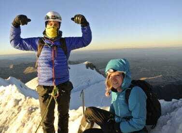
Prices From $1,386 / £1,127 per person
Duration: 4
Capacity: 16 people
More on climbing and mountaineering course Most of the course takes place on a glacier at around 5,000m/16,404ft and is open to complete beginners. Top level, professional guides show you how to plan and execute a successful climbing expedition. We begin by taking a look at the hazards that snow…Chimborazo & Cotopaxi Climb
https://www.andeantrails.co.uk/tour/climb-chimborazo-cotopaxi-ecuador/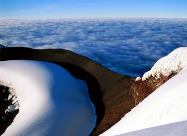
Prices From $3,505 / £2,850 per person
Duration: 13
Capacity: 16 people
More on Cotopaxi and Chimborazo climbing holiday Climbs are fully supported and led by qualified English-speaking guides, and are open to all levels of climbers. We provide the technical kit you need while you learn the ice skills required during the glacier schools we run. As well as pushing yourself…Climb Huayna Potosi in Bolivia
https://www.andeantrails.co.uk/tour/huayna-potosi-climb/ a Group Tour
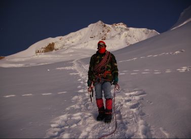
Prices From $1,122 / £912 per person
Duration: 3
Capacity: 16 people
Climb Huayna Potosi in Bolivia, the perfect Andean mountain for novice or experienced mountaineers. Huayna Potosi, despite its mighty 6,088m/19,974ft, is a straightforward climb and a great challenge for anyone looking to end a trek in style. The summit provides amazing views of La Paz, El Alto, Illimani, Mururata, the Amazon…Cotopaxi Climbing Tour, 3 volcanoes in 6 days.
https://www.andeantrails.co.uk/tour/cotopaxi-guided-climb-tour/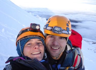
Prices From $1,999 / £1,625 per person
Duration: 6
Capacity: 16 people
More on Cotopaxi climbing tours You climb three of Ecuador’s impressive volcanoes: Pichincha (4,784m/15,696ft), Iliniza North (5,126m/16,818ft), and Cotopaxi (5,897m/19,347ft). The breathtaking views and sense of achievement make all the effort well worthwhile. Please make sure you are already well acclimatized (5 nights or more in Peru, Bolivia or on…