Condoriri Trek & Huayna Potosi Climb
Combine the Condoriri trek with a climb of the spectacular Huayna Potosi peak.
Join us for some superb high altitude hiking and mountaineering in Bolivia.
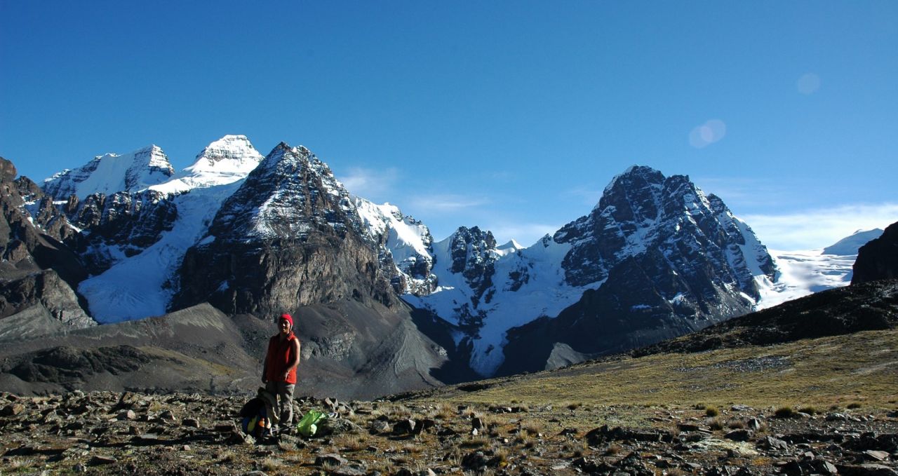
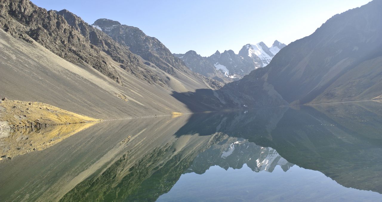
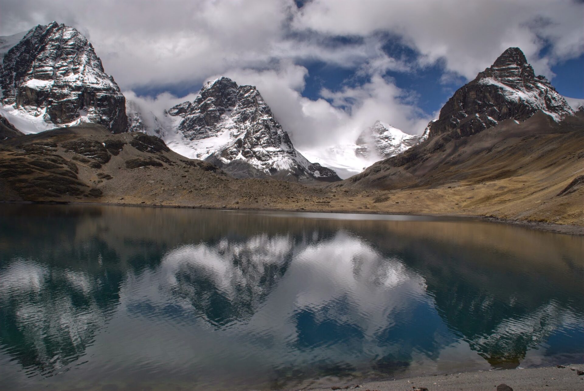
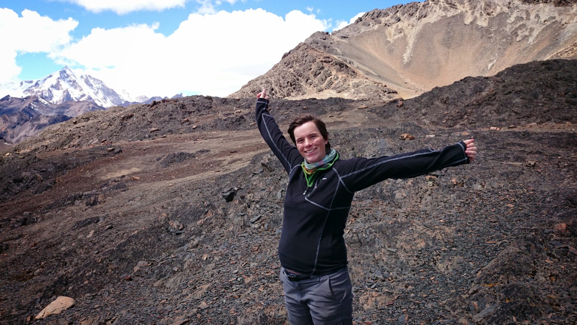
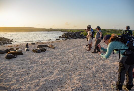
Hikers love walking and hiking in the majestic Cordillera Real mountain range. This area is great for spotting condors and Real’s outline resembles this iconic Andean bird taking off.
We walk up close to beautiful glaciers, lakes and are always accompanied by mountain views on the trails.
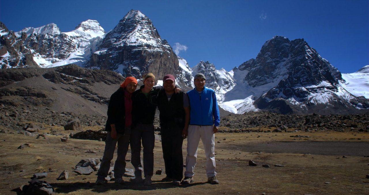
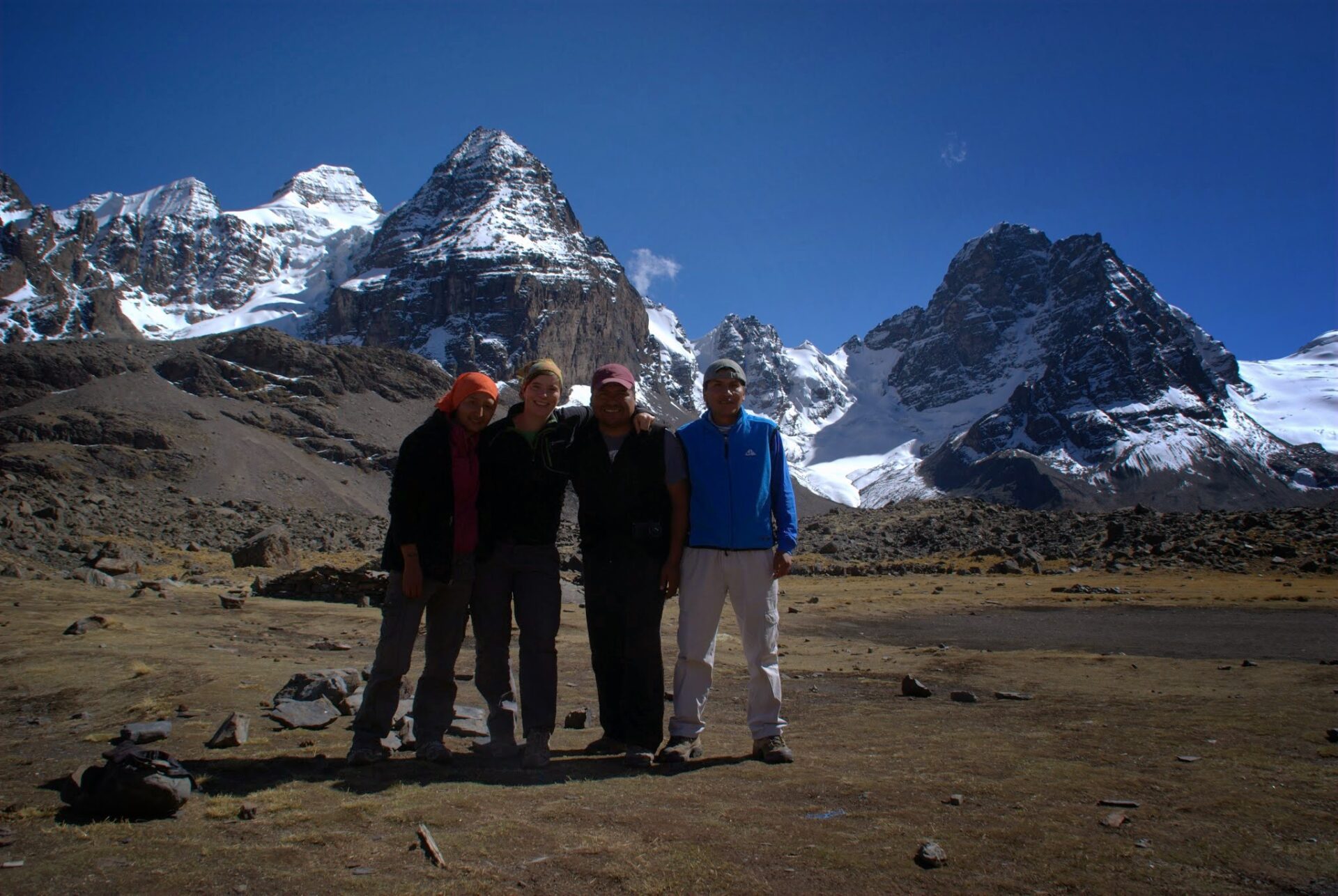
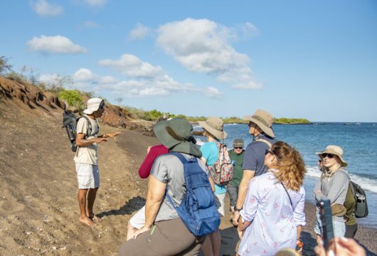
This fully-supported hike runs smoothly thanks to our professional guides, a cook, pack animals and full support staff team.
More on Condoriri trek and Huayna Potosi
Having spent most of the trek above 4,500m/14,764ft, you will be well acclimatised for our next goal.
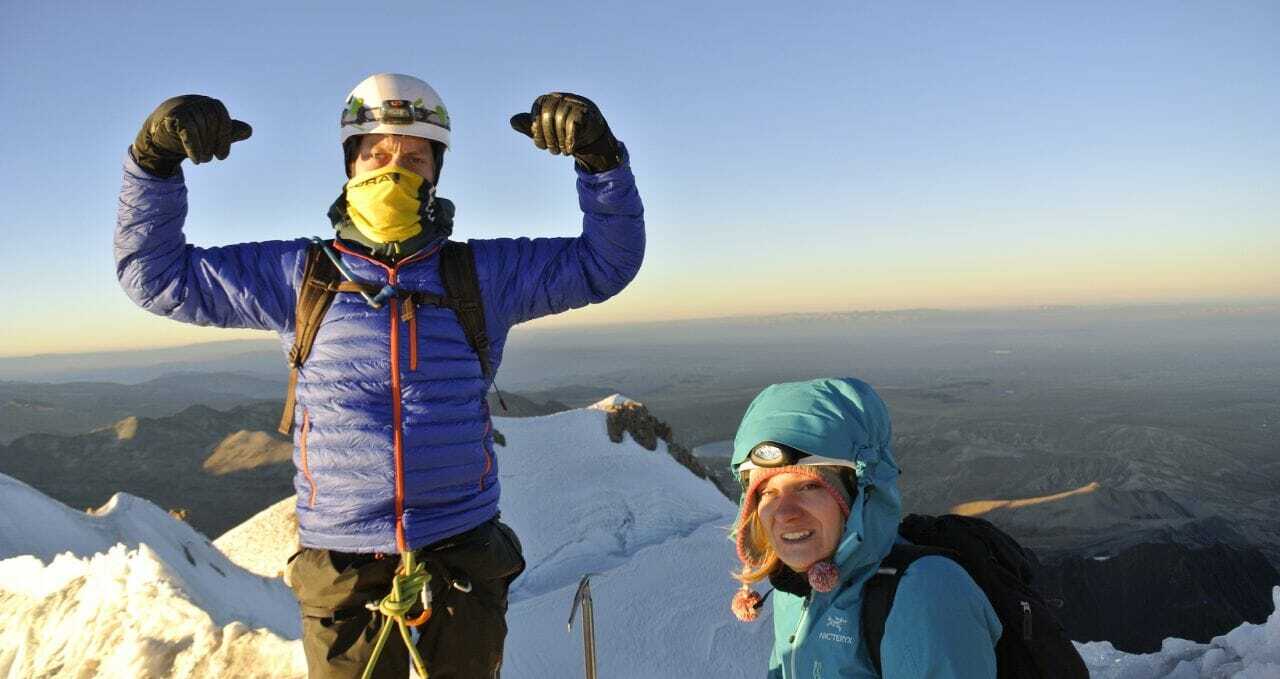
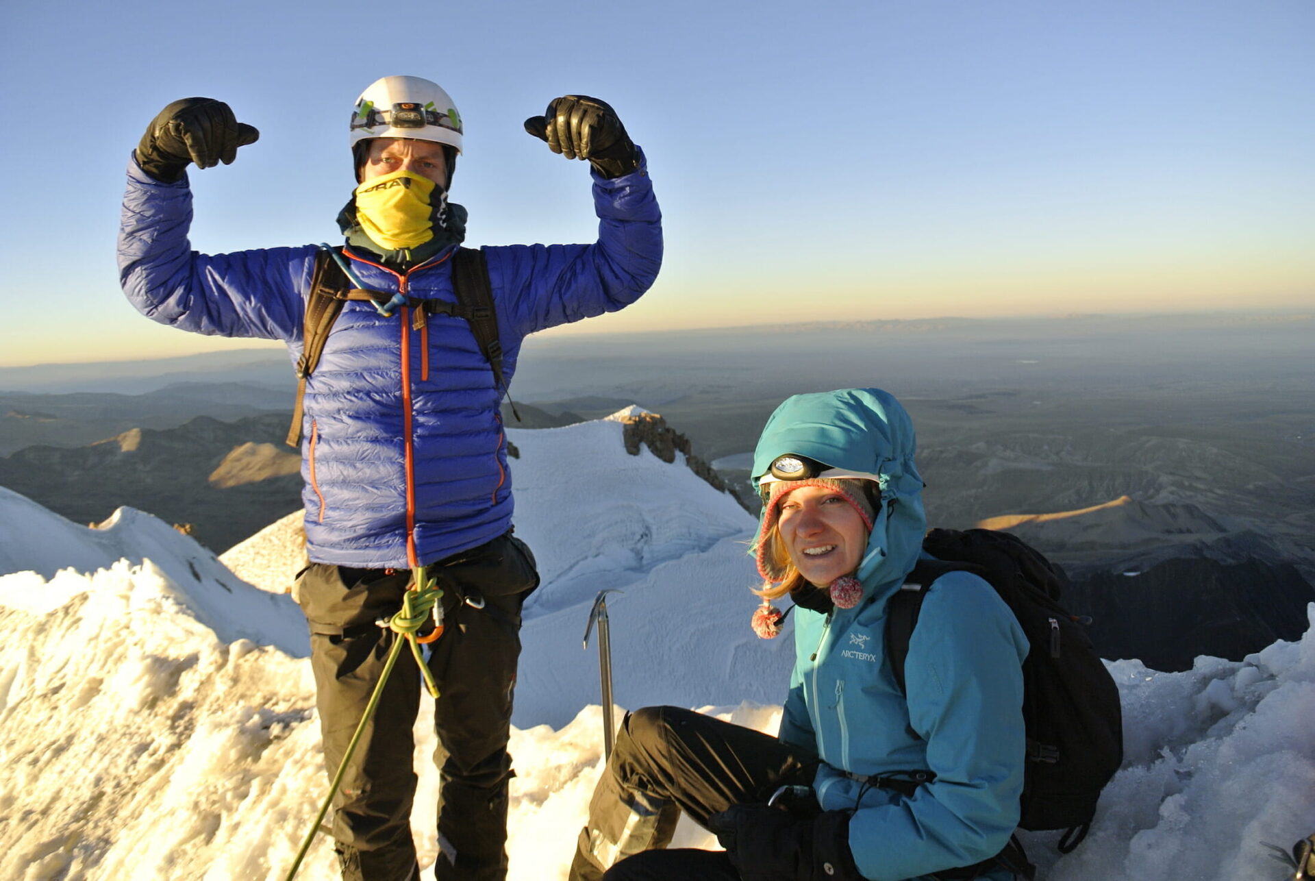
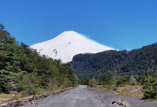
Huayna Potosi (6,088m/19,974ft) itself is a relatively easy ascent for such a high peak. It is the perfect Andean mountain for novice or experienced mountaineers.
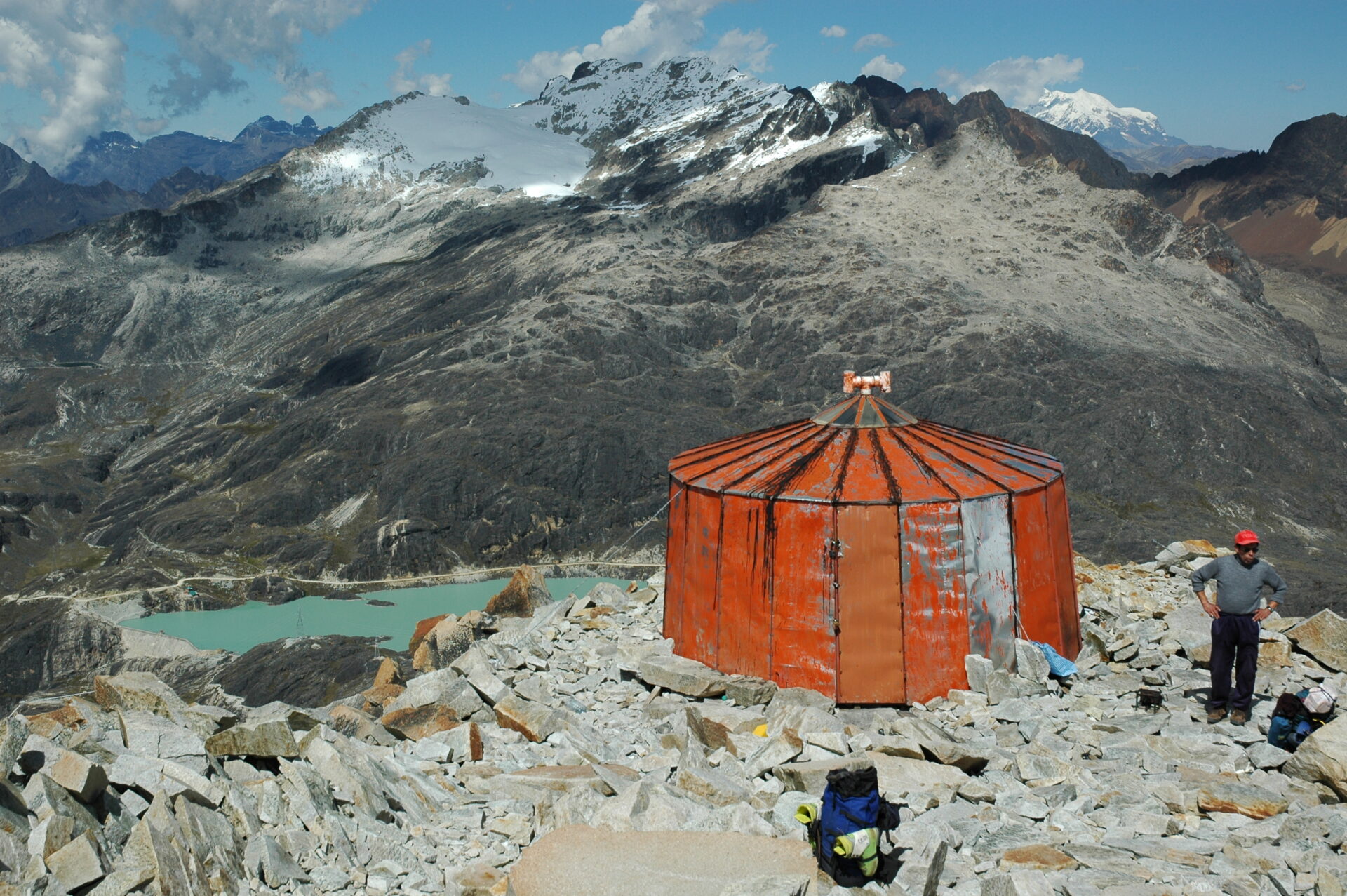
The summit provides amazing views of La Paz, El Alto, Illimani, Mururata, the Amazon Basin, Condoriri, the Cordillera Real, Altiplano and even Lake Titicaca.
Read our blog with tips and advice on how to make it to the summit.
Trip Highlights
Print Share Download as PDF-
Stunning mountain views of the Cordillera Real.
-
Remote Andean valleys.
-
Ascent of 6,088m Huayna Potosi.
-
Get up close to the Condoriri mountains, glaciers and lakes.
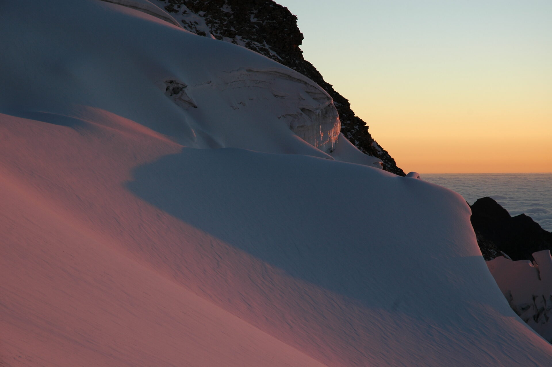
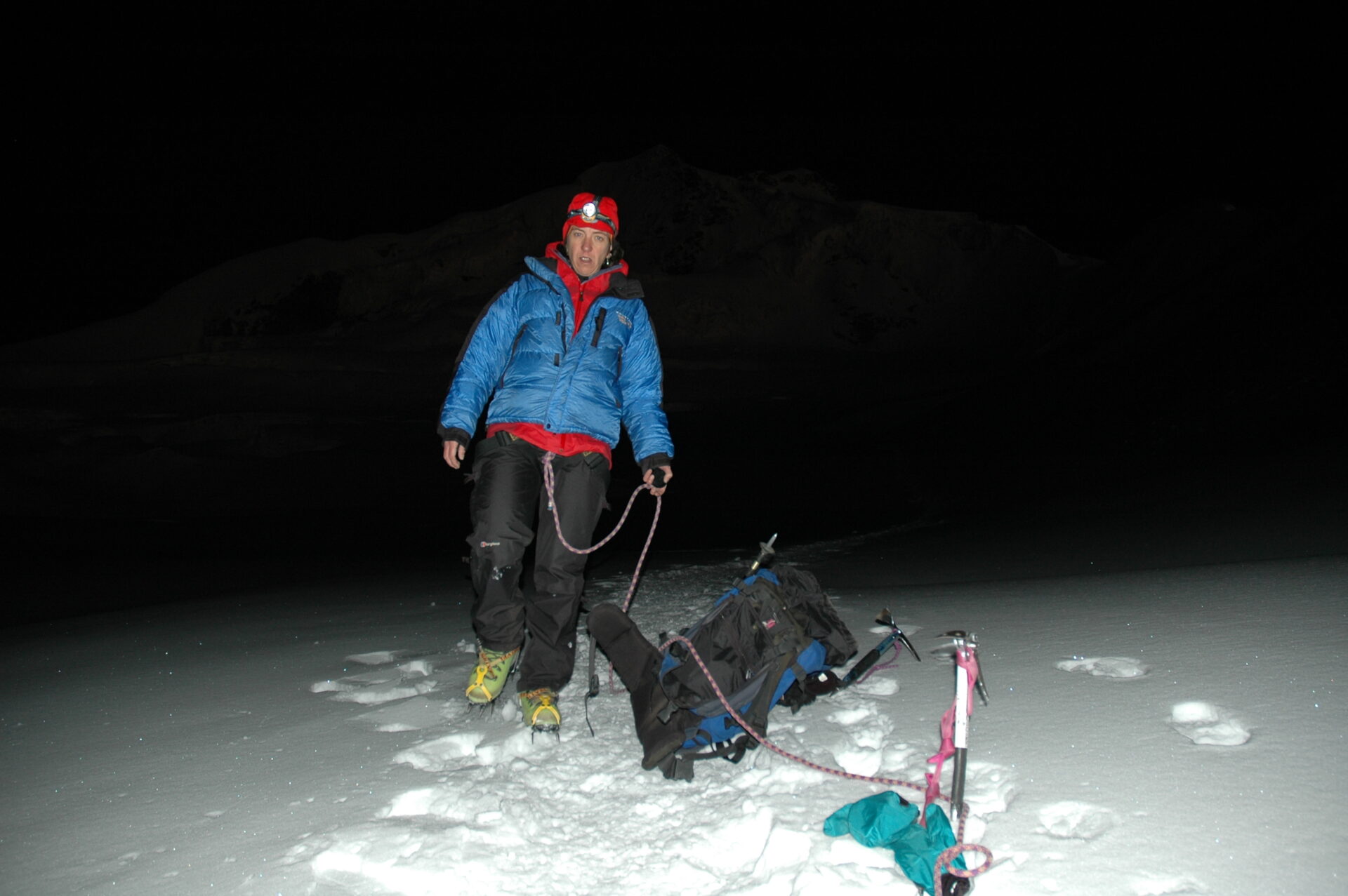
The descent was also magical, seeing the terrain we'd hiked in the dark in all is spectacular icy glory.
T. Foster, Huayna Potosi climb
Gallery
Videos
Full Itinerary
Day 1: Drive La Paz to Rinconada, trek to Laguna Jurikhota (4,700m), camp (L,D)
Transfer from La Paz to Palcoco (2 hours), an agricultural farming community.
From here we head off to Palcoco valley, and travel through here for 40 minutes to arrive at Rinconada (4,400m/14,436ft). We have lunch here and then set off hiking.
It’s three hours trek from here to our destination, Laguna Jurikhota (4,700m/15,420ft).
Here we camp, at the base of the glaciers of Ala Oeste.
Day 2: Condoriri glacier, Austria pass (5,150m) to Laguna Chiarkhota, camp (B,L,D)
Today we’ll be up well over 5,000m/16,404ft as we hike over a pass to Laguna Chiarkhota (4,650m/15,256ft).
After breakfast we head up to 4,900m/16,076ft to take a close-up look at the Condoriri glacier. We get a good look at frozen lakes and the seracs here. Seracs are blocks or columns of ice formed by intersecting crevasses on a glacier.
From here we push up and over the Austria pass (5,150m/16,896ft) and enjoy its views, before descending to Laguna Chiarkhota (4,650m/15,256ft) where we set up camp following today’s 6-hour trek.
Day 3: Hike to Maria Lloco, camp (B,L,D)
A similar length of trek today (6 hours), we start out after a lovely breakfast along a path that traverses lakes and abandoned mines.
These lovely distractions help pass the time until we arrive at Maria Lloco, a campsite with incredible views.
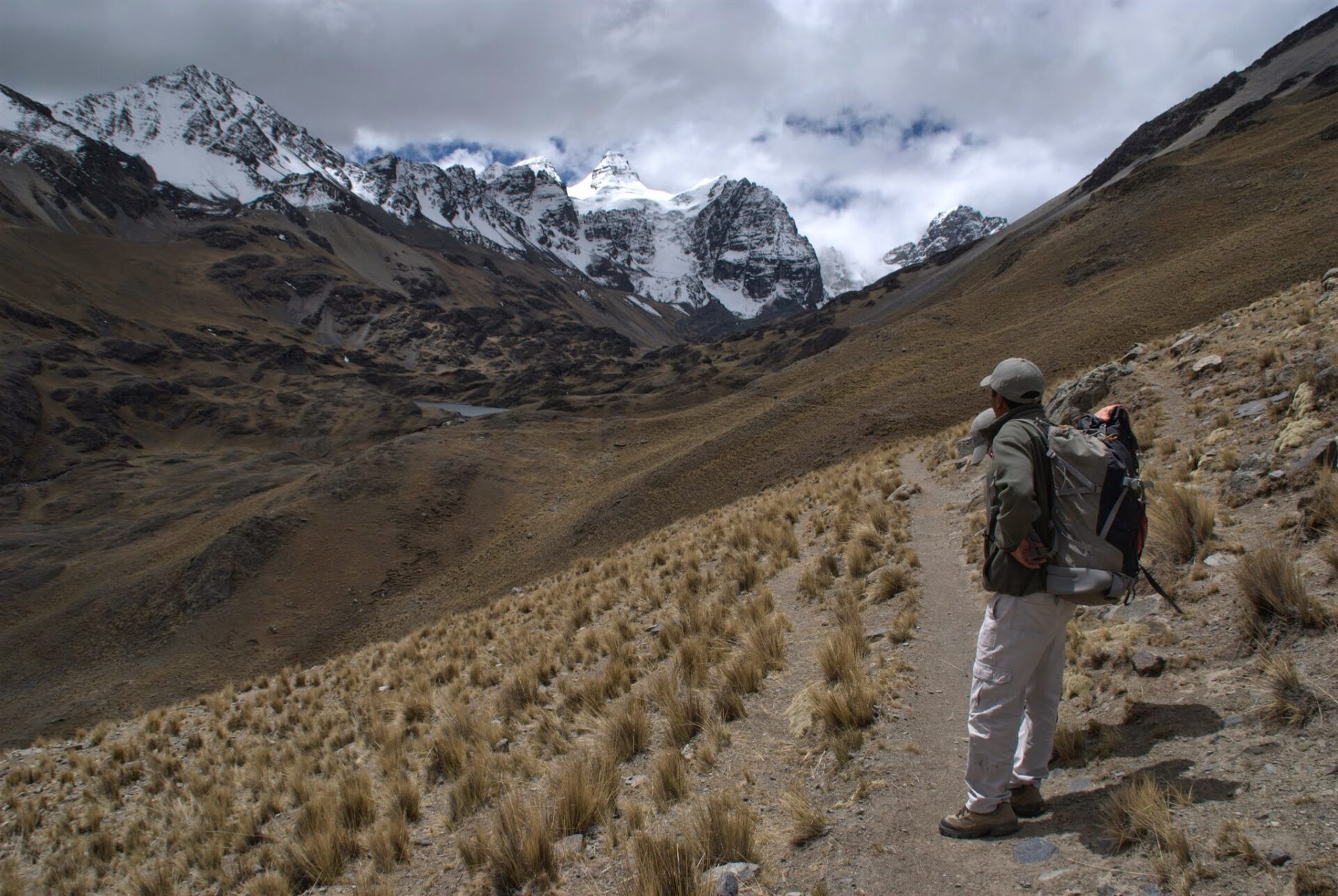
Our base will be facing the spectacular east face of our goal, Huayna Potosi.
Day 4: Short trek to Huayna Potosi base camp (B,L,D)
A four-hour uphill trek to start the day to reach a high pass of 5,050m/16,568ft, Paso Milluni.
From here we can see the snows that surrounds the glaciated peak of Huayna Potosi (6,088m/19,974ft).
We descend rapidly on the other side of the pass for about 90 minutes to get to the basic mountain refuge at the foot of Huayna Potosi (4,760m/15,627ft), for a warming cup of tea and a chance to relax.
Day 5: Trek from base camp to mountain refuge (5,130m) (B,L,D)
After breakfast, we start trekking up a rocky track through the morraines of Huayna Potosi. This is typical of walks in to the base of glaciers in a high mountain environment and does not require the use of any climbing equipment.
After two to three hours we arrive at Refugio Rocas (5,200m/17,060ft), located right near the glacier base, where we will cook up some supper and spend a short night.
This is an extremely basic mountain refuge.
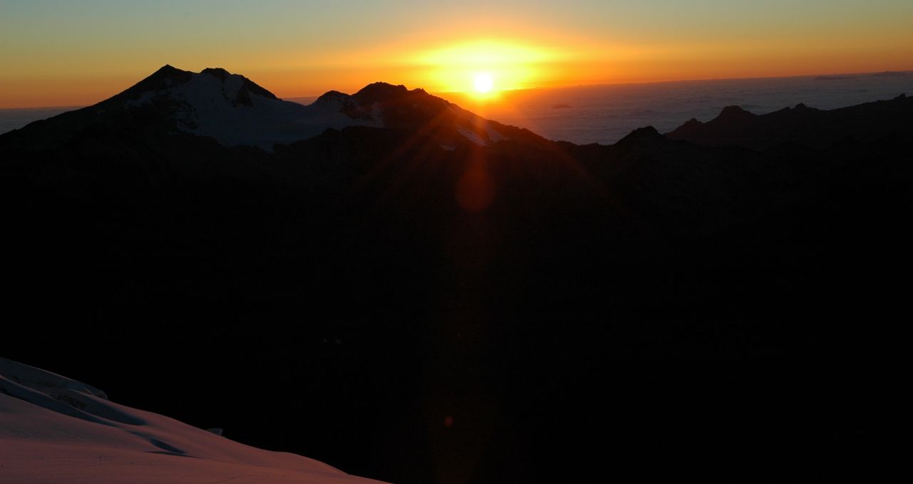
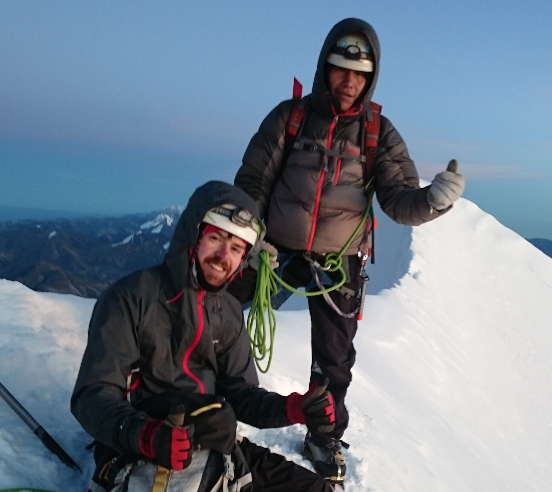
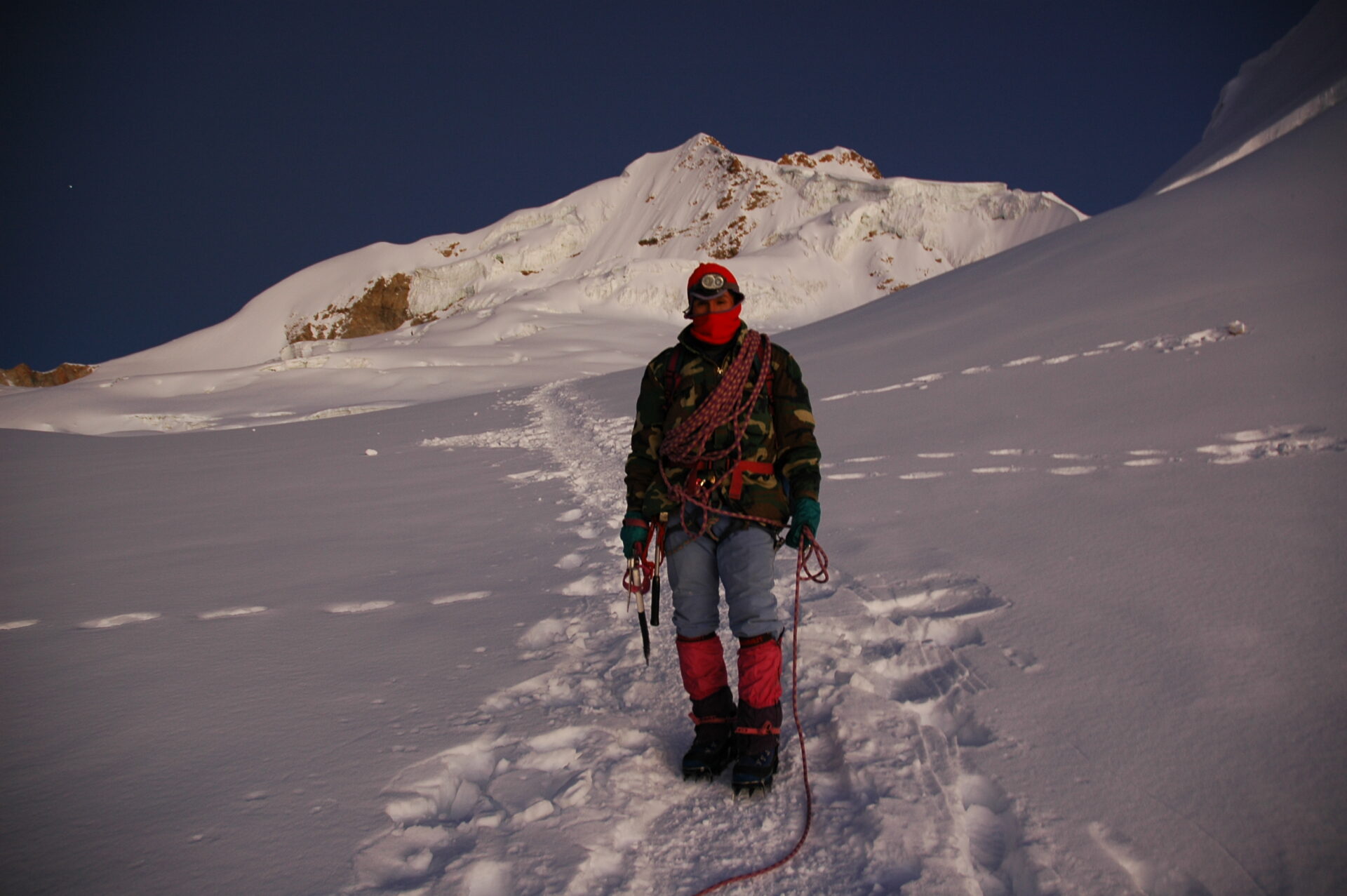
Day 6: Trek from refuge to summit (6,088m), return to La Paz (B,L)
After breakfast at 1am, we will prepare our mountain gear to start our summit climb at 02.00.
The normal route is not particularly technical though it does help if you have previous high mountain experience and experience of use of an ice-axe and crampons.
The ascent presents two steep sections, the first at 5,700m/18,700ft, and the second at 5,900m/19,357ft.
We will be roped up at all times and the guides will be instructing in how best to move all the way up.
After 5-6 hours we will reach the summit (6,088m/19,974ft) and enjoy an incredible 360º view.
Returning to high camp (3 hours), we have a quick lunch and return to base camp (1 hour) from where we return by vehicle to La Paz, arriving there late afternoon.
Prices From $2,099 / £1,706 per person
What's Included?
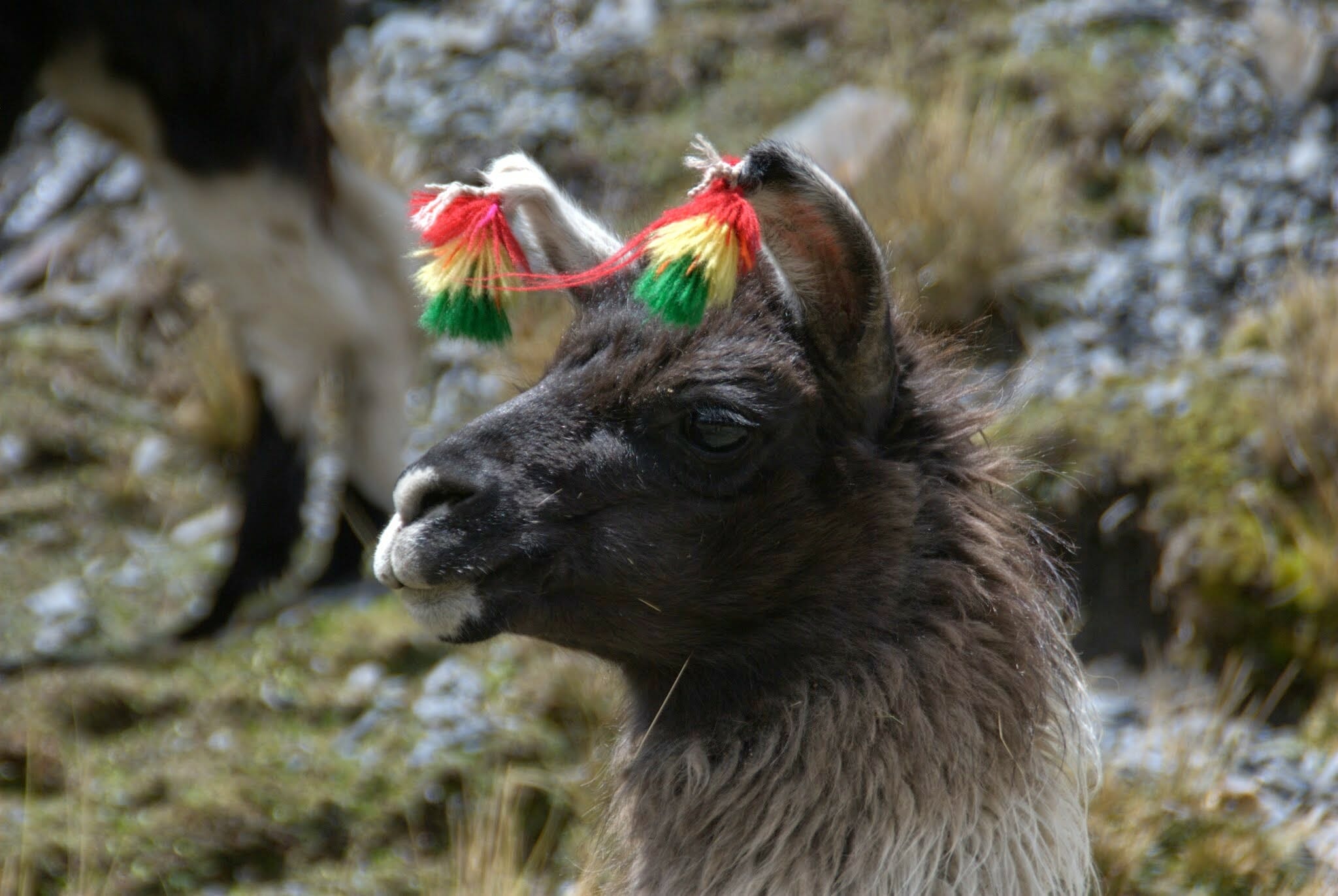
English speaking trek guide, cook, mules or llamas for kit transport, cook and dining tent, all group camping equipment, private transport to and from the trek, meals and water, Condoriri entrance fees, refugio fees, mountain guide.
What's Not Included?
International flights (we can look for these for you), travel insurance, sleeping bag, mountain clothes, items of a personal nature and tips, La Paz hotels
Accommodation
On the trek, we use two-man, high mountain tents. There is a dining tent and toilets are a mix of toilet tent and latrines.
On the climb we use two local mountain refuges on this route – both are basic.
Tour Staff
All guides are certified, bilingual, English-speaking guides who have worked with us for many years.
Cooks, mule drivers and additional staff are all from the local communities and we have worked with them for a long time.
Meals
Vegetarians and many other dietary requirements are catered for without problems. Please let us know in advance of any requirements you have.
You wake early, usually around 07.00. Breakfast is served in a dining tent, and consists of hot drinks, porridge, toast, jams and bread, and your guide will explain the day’s plans.
Lunch is usually around 13.00 and can feature soups, meats, salads and fish, with vegetarian options and hot drinks too.
The campsites are comfortable and around 17.00 hot drinks, popcorn and other snacks are served to help you recover energy.
Dinner is served around 19.30, and will feature pasta, quinoa, mashed potatoes, meat, fish or vegetarian options, followed by hot drinks and a pudding.
Activity Level
The trip is open to anyone with a positive attitude, but the fitter you are, the more you will enjoy it as climbing at high altitude is always a breath-taker.
We spend several days walking at high altitude, going over high passes, and spend a large amount of time above 4,500m/14,764ft.
You need to have a very good level of fitness for this trip, as summiting a peak higher than 6,000m/19,685ft requires fitness and determination.
You will need to have spent a good few days acclimatising in La Paz (3,655m/11,911ft) or higher, as well as doing some acclimatisation walks to higher altitudes – please ask.
Practical Information
An introduction to Bolivia
Land-locked Bolivia is a country of dramatic landscapes and fascinating native cultures and traditions.
The Altiplano or “High Plain”, averaging 3,800m, is its most populous region. The vast, luminous plateau is flanked to east and west by parallel Andean ranges.
La Paz, the world’s highest capital, lies in a deep canyon at the edge of the Altiplano, and at the foot of Illimani (6,400m). It is a striking city for its dramatic setting and its strong Indian character.
Lake Titicaca is the world’s highest navigable lake. It was sacred to the Incas; according to legend, their founding emperor-gods rose from these waters to give birth to their empire. Just south of the lake stands the sacred pre-Inca site of Tiahuanaco.
Geography of Bolivia
On the south-western Altiplano are the Uyuni Salt Flats, the largest in the world. Here, the shimmering white salt pan and deep blue sky combine to create a truly magical spectacle.
The stunning Cordillera Real is a mountain range dominated by huge snow peaks, including Illimani and Illampu (6,380m). The Real divides the northern Altiplano from the tropical forests to the east. The Cordillera Real’s eastern slopes are characterized by the deep, sub-tropical Yungas gorges.
Further south, the tropical Chapare is the agricultural heart of Bolivia. East of this band of high forests and plantations lies Bolivia’s Oriente, a vast swathe of Amazonian jungle and savanna accounting for 2/3 of the country and featuring some of the last untouched wilderness on earth.
In the north-eastern Department of Beni, some 50% of the country’s mammals and birds reside. Below, and in no special order, we outline some of the top places to go and things to do.
Weather in Bolivia
Bolivia lies within the tropics, between latitudes 10º and 22º south. The climate, as varied as its geography, is affected by latitude and, especially, by altitude.
The best time to travel is the winter (dry season) between May and Oct when, typically, weather systems over the Andes are stable, and overall you can expect bright sunny days and cold clear nights. Most of the rain falls from Dec to March. Climate can be divided into these distinct zones:
The Andes and the Altiplano
There is relatively little precipitation on the Altiplano, especially in the dry season – most rainfall is from Dec to March. However, there is periodical, localised rain on high peaks and valleys all year round.
The further south and west you go on the Altiplano, the drier are the conditions; around Uyuni, semi-arid conditions prevail. The Andean sun’s rays are very strong.
Temperature-wise, the Andes and Altiplano experience significant fluctuations over a single day. At 4,000m, the pre-dawn temperature can drop to -15ºC, while noon temperatures at the same location can reach 20ºC.
Southerly cold winds mean the southern Altiplano is not only drier, but also noticeably colder and windier than the north (pre-dawn temperatures at Uyuni in July regularly drop to -20ºC).
On treks in the Cordillera Real in the dry season, expect a range of conditions within a single day: cold/freezing nights at camps above 4,000m (where pre-dawn temperatures sometimes reach -15ºC); warm, spring-like mornings and afternoons; and cold evenings. Conditions are generally dry, but note that mountain weather is fickle and localised, and precipitation is not unusual in the dry season.
Expect temperatures to swing between sun and shade, sheltered and exposed ground and with altitude gain and loss. A quick-setting sun means temperatures drop fast.
The city of La Paz (3,630m) is relatively sheltered. Average high/low temperatures range from 1-17ºC in June and July (coldest months) to 6-19ºC in Nov and Dec (warmest months). In June and July, it rarely rains more than 1 or 2 days per month, while in January there are on average 15 wet days.
The tropical lowlands & yunga (Amazon)
Year-round, weather conditions in the Amazon basin are hot and humid and always with the chance of rain.
There is a ‘cooler’, drier winter season between May and October. During this ‘dry season’, the average daytime high temperature is between 25-31°C and the average nighttime low is between 16-22°C.
In the dry season, heavy downpours typically occur every few days.
Note that around 80% of annual average rainfall – approx 2,000 mm in Bolivia’s northern lowlands – occurs in the wet season, Nov-April.
On rare occasions, between May and September, cold fronts from Argentina – surazos – can sweep into southwest Amazonia and push temperatures down to 9°C. (Surazos usually last between 1 and 3 days).
The Yungas shares the same dry/wet months but varies from quite wet to very wet depending on whether it is the ‘dry’ or rainy season. Average temperature is 24°C.
Kit list
Good kit is vital for every trip.
Book with Andean Trails and get 15% off Páramo’s fantastic ethical and high performance outdoor gear.
When planning for the extreme climatic conditions encountered on high peaks in the Andes, layering is the most practical and versatile clothing system. It’s worth remembering that our clothing keeps us warm by retaining and isolating the heat we ourselves create.
To best maintain body heat, several layers of lightweight, warm and quick-drying clothing are far more efficient than one or two thick layers.
Layers should have the following qualities:
- Breathability (able to wick away the humidity produced by sweat);
- Isolation (able to keep in the warm air our body produces); and
- Impermeability (able to impede the passing of wind and water).
First (base) layer: This layer wicks the sweat away from our skin, thus helping keep the body dry and warm. To this end, synthetic fabrics such as polypropylene should be used.
Mid layers: These isolating layers should also be synthetic (e.g. the known polar linings such as polartec or windblock, which are light and insulate twice as well as wool). Very important layers for retaining body heat.
Outer layer / shell: Finally, the vital layer which protects us from climatic adversities. A breathable, wind-proof and waterproof anorak, such as Goretex.
Note that it’s our extremities that stand to suffer the most, and on high Andean peaks the poorly-equipped mountaineer is at risk of becoming frostbitten. Hence, much thought should be given to deciding how best to protect hands, feet and head.
Give plenty of thought to kit selection, and try to keep weight down.
Below is a more detailed guide.
Feet
- 2 pairs synthetic inner socks (e.g. polypropylene, thermastat, coolmax)
- 4 pairs thick loop-stitch/wool socks for cold.
- Trekking boots – should be well broken-in, waterproof and provide good ankle support. Given the extreme cold, plastic mountaineering boots (e.g. Koflach) are also required. These are indispensable. (see ‘TECHNICAL KIT’ below)
- Gaiters (1 pair), heavy and large enough to fit over plastic boots.
- Trainers/sandals, for city-wear, evenings at lower camps & river crossings.
Legs
- Base layer leggings (1-2 pair).
- Thick fleece leggings (or salopettes) (1 pair).
- Goretex-type over-trousers (or salopettes) (1 pair).
- Trekking trousers (1 pair).
- Shorts – wear sparingly in early stages at altitude, as sun burns.
Body
- Thermal base layer shirts (2).
- Microfleece mid-layer shirt (1).
- Shirt/T-shirt 1 or 2 for lower altitudes. Long-sleeved, collared shirt protects against sun.
- Fleece jacket or similar (1).
- Warm jacket (down or synthetic) with hood. For camp and upper slopes.
- Waterproof Goretex-type jacket.
- 1-2 sports bras/tanks (for women)
Head and neck
- Broad-brimmed sunhat, essential.
- Warm hat, fleece or wool. (N.B. Up to 30% of body heat can be lost through the head).
- Balaclava/full-face ski mask (1)
- Sunglasses with UV filter and nose and side-pieces.
- 1 pair of glacier compatible sunglasses (full coverage – ask salesperson if you are not sure)
- Scarf for cold.
- Bandanna – to protect neck from strong sun.
- 1 cap with visor
Hands
For the extreme cold, we recommend a 3-layer scheme:
- 1 pair of Gore-Tex shell gloves
- 2 pairs of removable fleece glove liners
- Mittens allow you to keep the fingers together, and better conserve heat (though they also make it difficult to perform certain tasks).
Technical kit
- Large backpack (80-90 litres). Comfortable and with waterproof lining or cover.
- You will need another bag to store belongings left at hotel during expedition.
- Daypack (at least 30 litres). Comfortable and with waterproof lining or cover.
- Plastic mountaineering boots (you can rent these)
- Crampons, strap-on or step-in (can be rented)
- Walking ice axe (can be rented)
- Pair of telescopic trekking poles. (can be rented).
Other expedition kit
- Sleeping bag – a good warm bag (‘4-season’, minimum) and liner will be necessary for high-altitude camping.
- Sleeping mat, a foam mat is provided
- 2 x water bottles (2 litres each approx).
- Pee bottle.
- Personal first-aid kit to include: painkillers, plasters (band-aids), moleskin, anti-biotic cream, general antibiotics (ask your GP), after-bite (tiger balm), anti-diarrhoea tablets, throat lozenges, re-hydration salts & personal medication.
- Towel & wash-kit.
- Wet Wipes/antiseptic hand-wash cream.
- Sunscreen (factor 40+) and lip salve.
- Head-lamp (Plus spare bulbs and batteries x 2 at least).
- Penknife.
- Thermos flask (1 litre) Stainless steel.
- Alarm clock.
- Plastic bags ‘Zip-loc’ & tough bin liners.
- Camera and film / memory cards (take at least twice the amount you think you will need!).
- Book, e-book, mp3 player/ipod or other for free time.
- Binoculars.
- Spanish/English phrasebook.
- Extra snacks i.e. cereal bars or favourite chocolate bars.
All other non-personal trekking and camping equipment is provided, e.g. tents, cutlery etc.
ATOL holiday protection
Andean Trails has 25 years of experience of putting together the best South America holidays.
We pay a fee to the CAA for every licensable passenger we book since we hold an Air Travel Organiser’s Licence granted by the Civil Aviation Authority. In the unlikely event of our insolvency, the CAA will ensure that you are not stranded abroad and will arrange to refund any money you have paid to us for an advance booking.
We also offer ATOL (Civil Aviation Authority) protected holidays to give our customers peace of mind when booking and travelling.
When you buy an ATOL protected air holiday package from Andean Trails Ltd you will receive a Confirmation Invoice from us confirming your arrangements and your protection under our Air Travel Organiser’s Licence number 6275.
You can read more about ATOL, who is covered and what protections you have if not ATOL-covered, on our ATOL page.
What is ATOL?
The CAA’s ATOL scheme offers protection to your money and your holiday if you book with us. Not everybody is covered (see ‘Who is covered?’ for more), as you must purchase an ‘air package holiday’ with Andean Trails to be protected.
And ‘air package holiday’ is defined as including a flight and some ground services (hotel, transfer, trek etc). This is also known as an ‘ATOL-protected holiday’.
Who is covered?
To be covered by ATOL, you must book a flight and some ground services with us and be from the UK. If you are from the UK and only book ground services and no flights, you are not covered by ATOL (see below for more on how non-ATOL clients are covered).
If you are outside the UK and buy flights with us, you will be ATOL protected IF any of the flights booked with Andean Trails touches/stops in the UK at any point during your holiday package booked with us.
If you buy your flights elsewhere, please check with that agent if you are ATOL protected. Be careful with online flight purchases and make sure you know what protection you have, if any, before paying for flights.
Not all holiday or travel services offered and sold by us will be protected by the ATOL scheme. Please ask us to confirm what protection may apply to your booking.
For land only holidays not involving any air travel, in accordance with “The Package Travel, Package Holidays and Package Tours Regulations 1992”, all UK passengers booking with Andean Trails Ltd. are fully protected for the initial deposit and subsequently the balance of all money paid to us, arising from cancellation or curtailment of travel arrangements due to the insolvency of Andean Trails.
I’m not ATOL covered, what protection do I have?
If you are not ATOL covered, any payments you make to us go to a Trust account.
We can only access this money once your tour has been completed, meaning that if anything happens to Andean Trails Limited while you are on holiday, then your money is secure and you can either complete the trip or be able to make it home.
If you pay for your holiday with a credit card, some offer payment protection – please check with your cardholder.
You also should have cancellation protection written into your insurance (which we recommend you have at the time of booking) in case you need to cancel.
Prices From $2,099 / £1,706 per person
Guide price, per person, shared tent basis
Shorter/longer climbs possible
Price based on two people
4 people: USD 1,518 per person
Season runs May-September

Dates & Prices
Prices From $2,099 / £1,706 per person
Guide price, per person, shared tent basis
Shorter/longer climbs possible
Price based on two people
4 people: USD 1,518 per person
Season runs May-September
Can’t find what you’re looking for? Get in Touch
+44 (0)131 378 5593
+44 (0)131 554 6025
Suggested Trips
Climb Huayna Potosi in Bolivia
https://www.andeantrails.co.uk/tour/huayna-potosi-climb/ a Group Tour
  a Tailor Made Tour
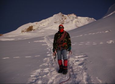

Prices From $1,122 / £912 per person
Duration: 3
Capacity: 16 people
Climb Huayna Potosi in Bolivia, the perfect Andean mountain for novice or experienced mountaineers. Huayna Potosi, despite its mighty 6,088m/19,974ft, is a straightforward climb and a great challenge for anyone looking to end a trek in style. The summit provides amazing views of La Paz, El Alto, Illimani, Mururata, the Amazon…Climb Sajama & Parinacota, Bolivia
https://www.andeantrails.co.uk/tour/sajama-parinacota-climb/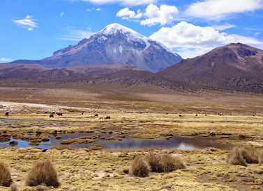
Prices From $4,450 / £3,618 per person
Duration: 17
Capacity: 16 people
More on Sajama and Parinacota climb This fully guided and supported trip offers you the opportunity to climb both these amazing volcanos. You will be in the company of our fully experienced mountain guide and English-speaking assistant. For trekking fans who want to enjoy the best high altitude walking in…Condoriri Trek & Hike, Huayna Potosi
https://www.andeantrails.co.uk/tour/hichukhota-condoriri-trek/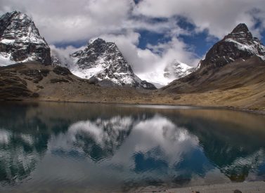
Prices From $1,585 / £1,289 per person
Dates: From May 2026 to October 2026
Duration: 5
Capacity: 16 people
A spectacular, fully-guided 5-day Condoriri Bolivia high mountain trek. Condoriri is a striking mountain to trek below – its three highest peaks together resemble a condor lifting its wings before take off. The great chain of majestic peaks of the Cordillera Real, to the north of La Paz, dominates the…