Choquequirao Trek to Machu Picchu
Take on the full Choquequirao trek to Machu Picchu. Visit two of Peru’s finest Inca ruins, near Cusco.
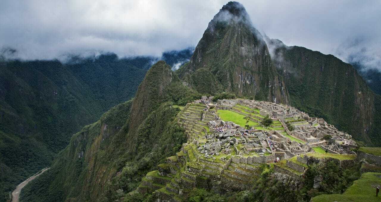
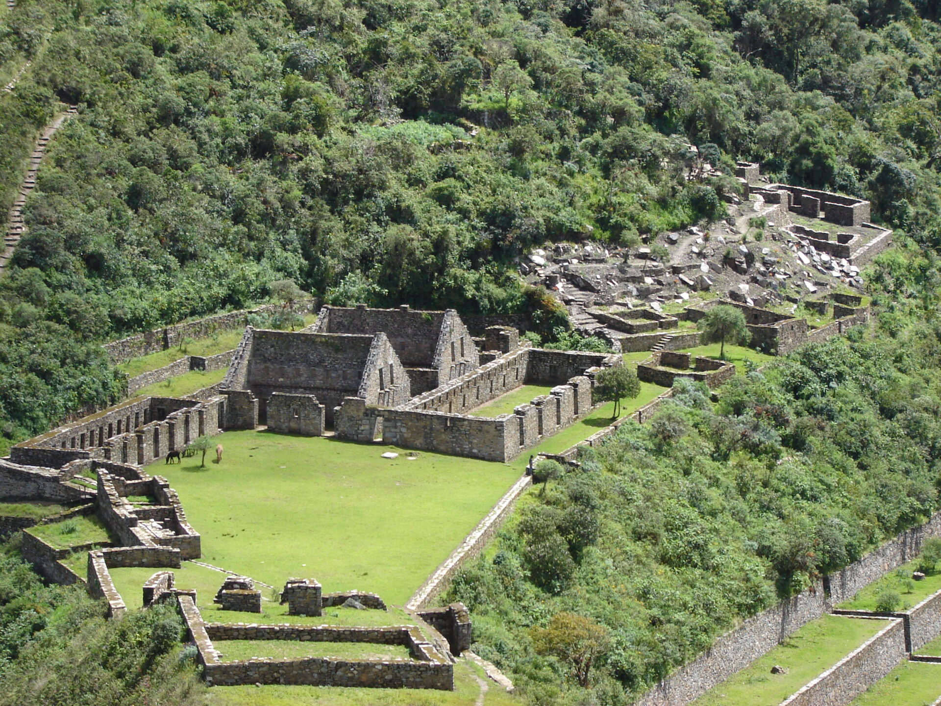
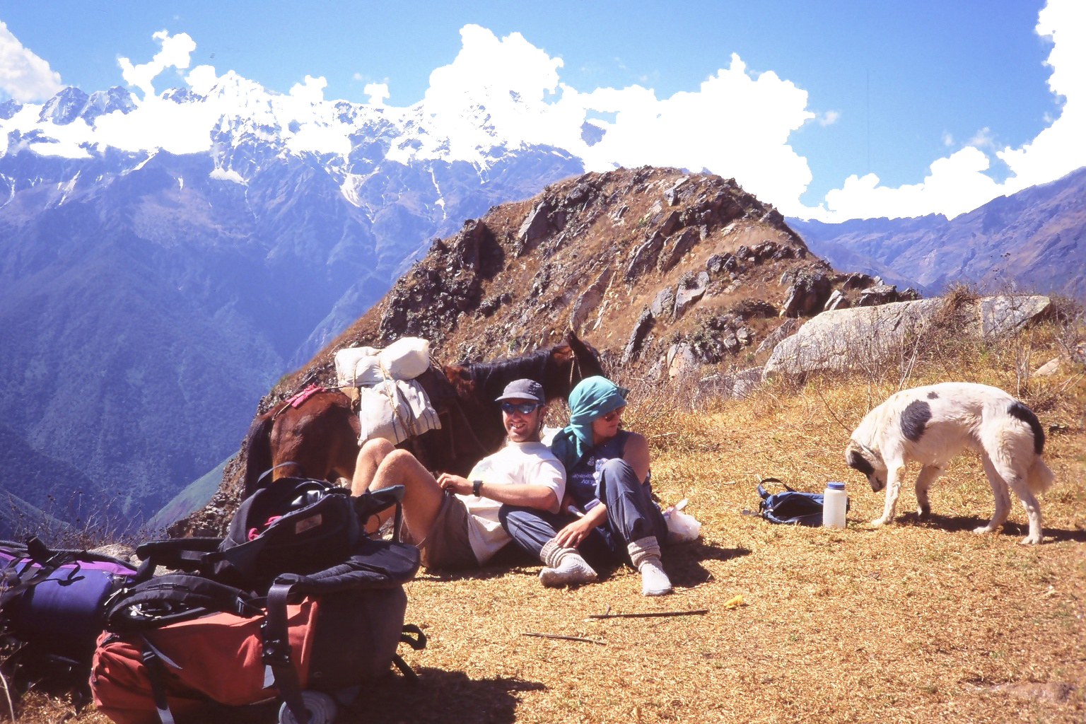
Choquequirao, or Chokekirao, is comparable in size to Machu Picchu, dramatically located on a promontory nearly 1,700m above the Apurimac River.
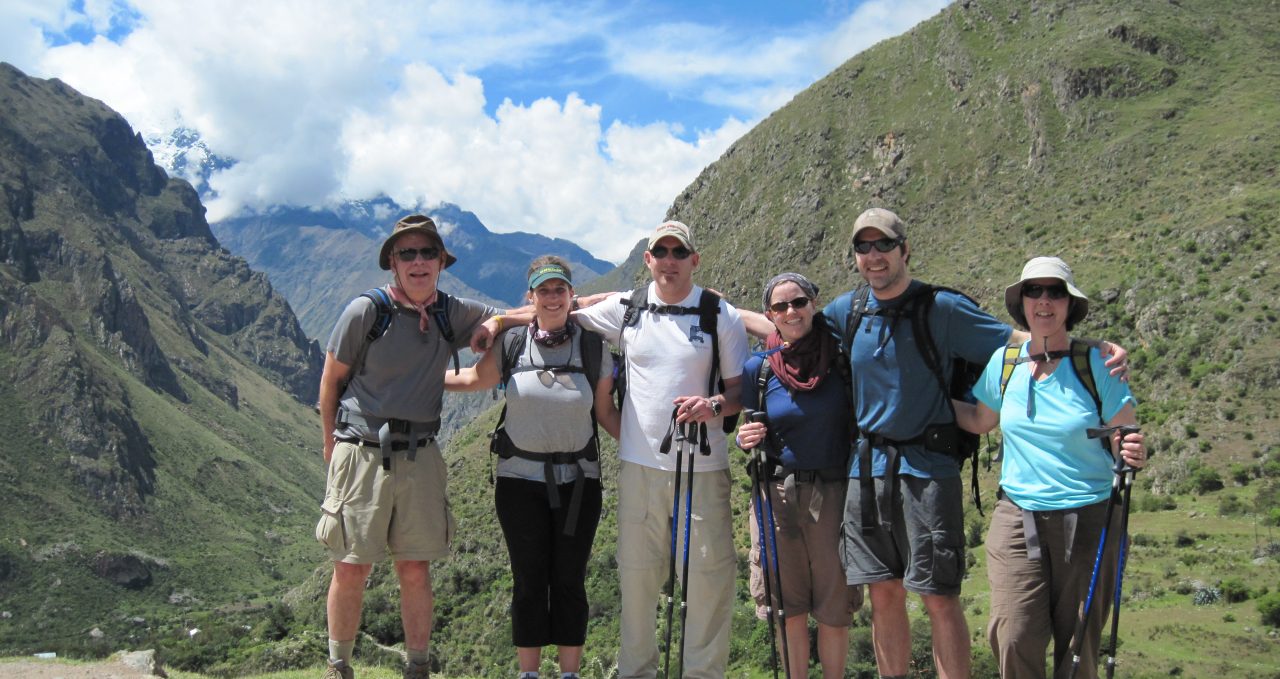
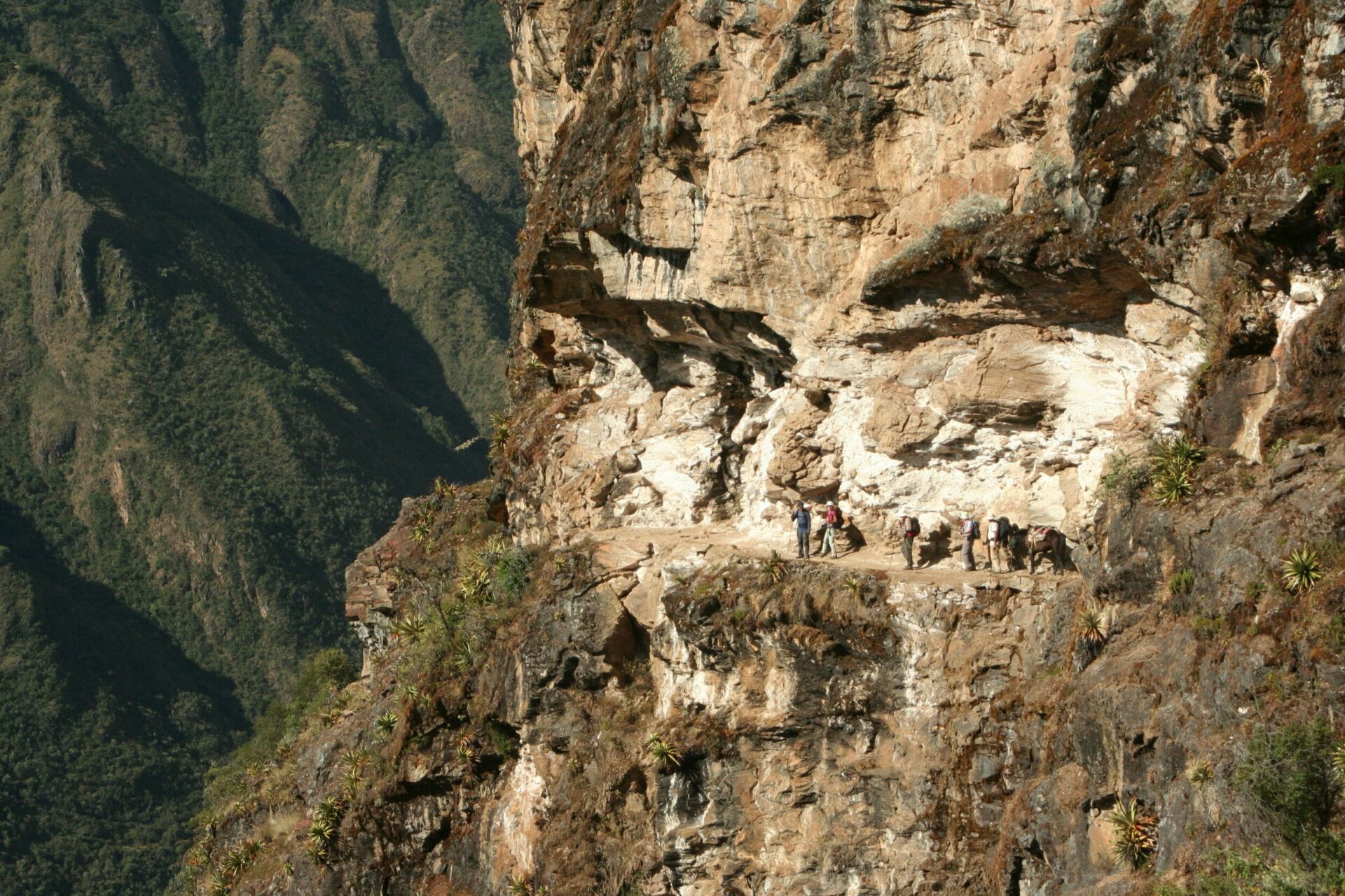
It is only accessible by this tough trek, and our mule-supported hike takes in high passes, perfectly preserved Inca Trails and awesome Andean peaks.
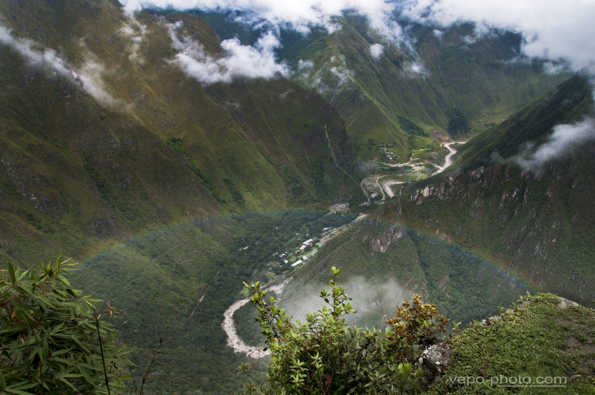
Our hiking reward is a spectacular and rarely seen view of Machu Picchu.
More on Choquequirao trek to Machu Picchu
The trek is approximately 55 km / 34 miles long with almost 3,000 m/9,850 ft of both ascent and descent.
We traverse high passes of up to 4,600 m/15,092 ft and river crossings as low as 1,450 m/4,757 ft.
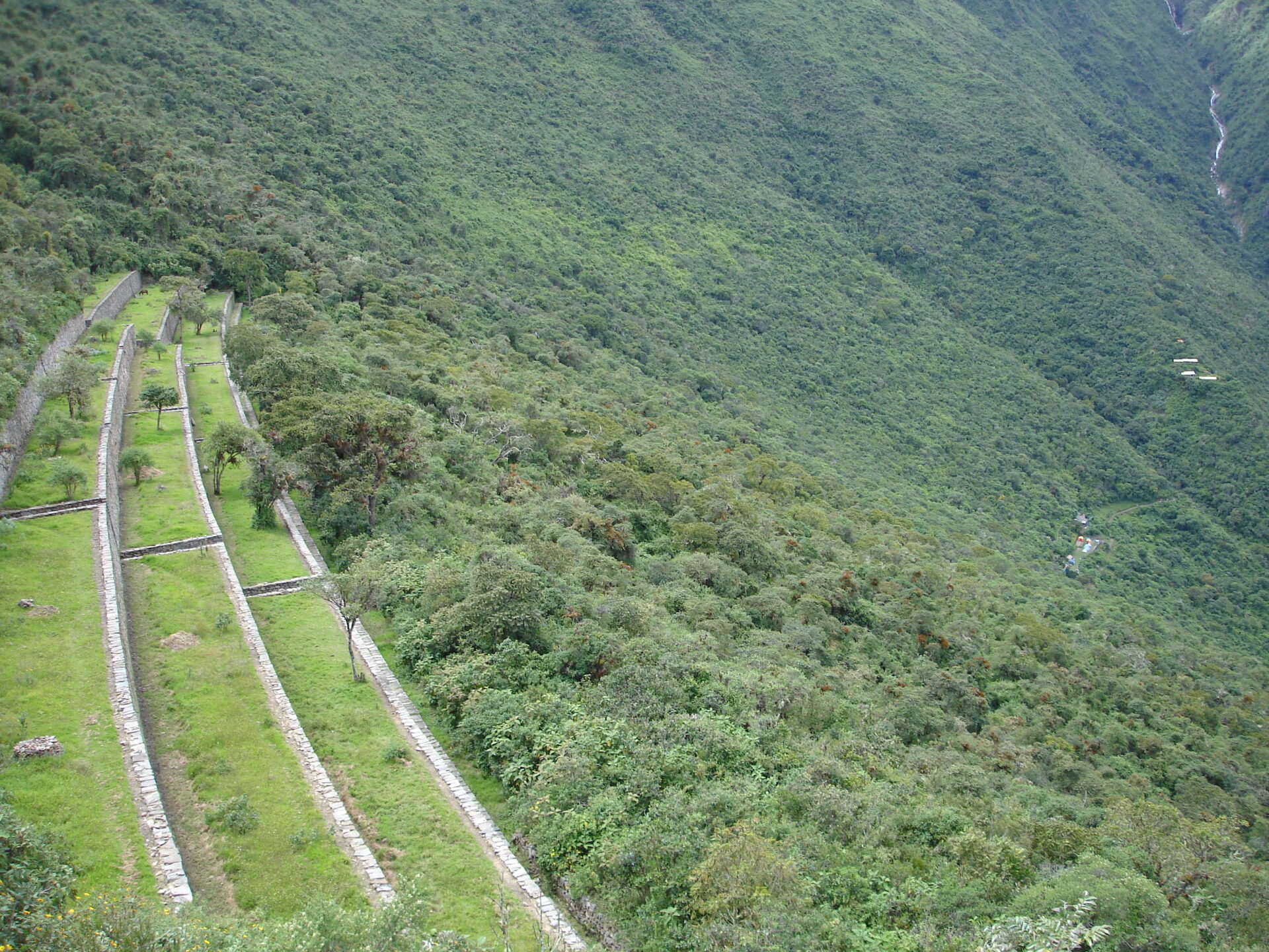
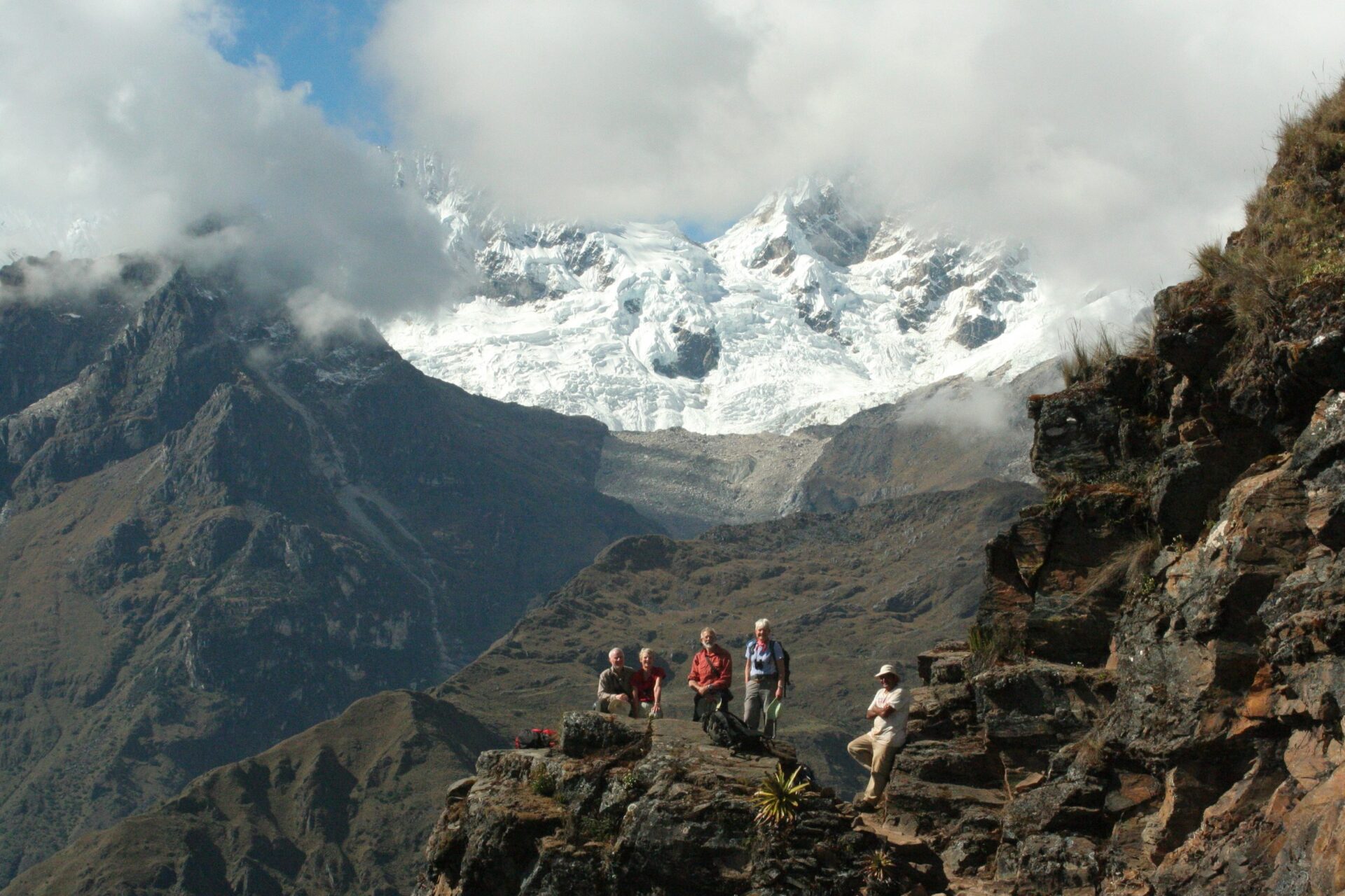
You pass from the ice-capped peaks of the high Andes – all sharp ridges, deep gorges and raging rivers – to the lush flora and prolific wildlife of the sub-tropical rainforest.
Choquequirao trek to Machu Picchu is one of the finest and most satisfying treks and routes near Cusco.
Trip Highlights
Print Share Download as PDF-
The magnificent Choquequirao trek to Machu Picchu passes through two of Peru's finest Inca sites.
-
Remote Choquequirao ruins attract few visitors, so you can explore freely.
-
Unique views to Machu Picchu.
-
Pass through varied eco-systems from high Andes to sub-tropical rainforest.
-
Fully supported trek, the ultimate back-door route to Machu Picchu.
-
Excellent guides will bring the Inca civilisation to life for you.
Choquequirao was fabulous, remote , a real sense of achievement having trekked in, the guide was really informative and there was a spiritual feel to it.
P. Conlen, Choquequirao trek to Machu Picchu
Gallery

Videos

Full Itinerary
Day 1: Cusco - Cachora - Choquequiaro Trekking (L,D)
We leave Cusco for the drive to the village of Cachora, where our trekking team will be waiting near the trailhead.
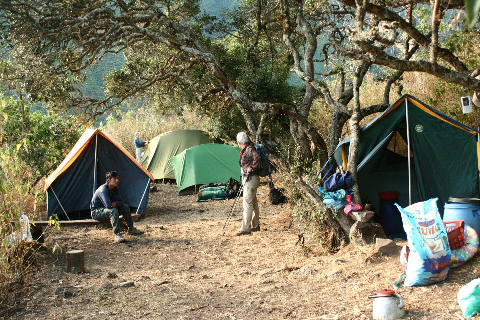
We have an early lunch then start the descent along a switchback trail, 1600m (5250ft) into the Apurimac canyon and the small settlement of Chikiska. We camp here for the night.
Day 2:Chikiska to Choquequirao (B,L,D)
After breakfast, we continue downhill and across the roaring Apurimac River. We continue to climb up past the settlements of Santa Rosa and Maranpata to our camp next to the Choquequirao ruins.
It’s a steep, but good, path and it can get hot! This is a tough day and we need to get on the road early but the scenery makes it all worthwhile!
Day 3: Explore Choquequirao (B,L,D)
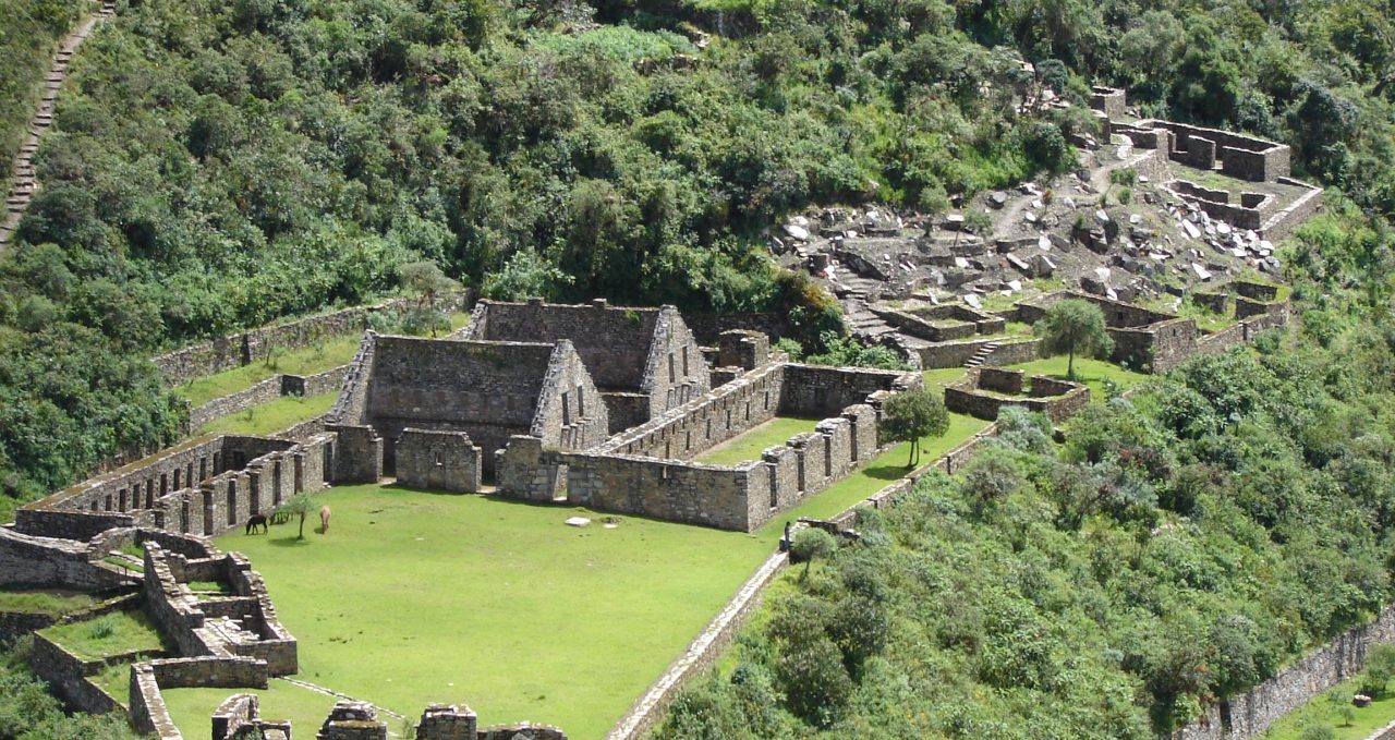
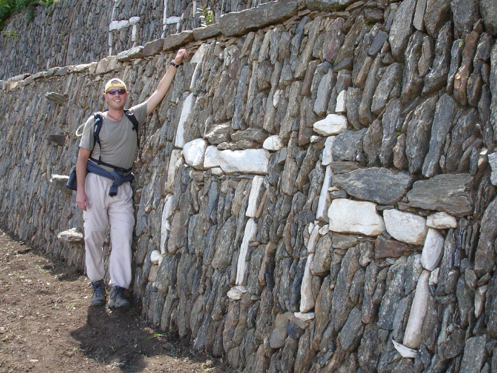
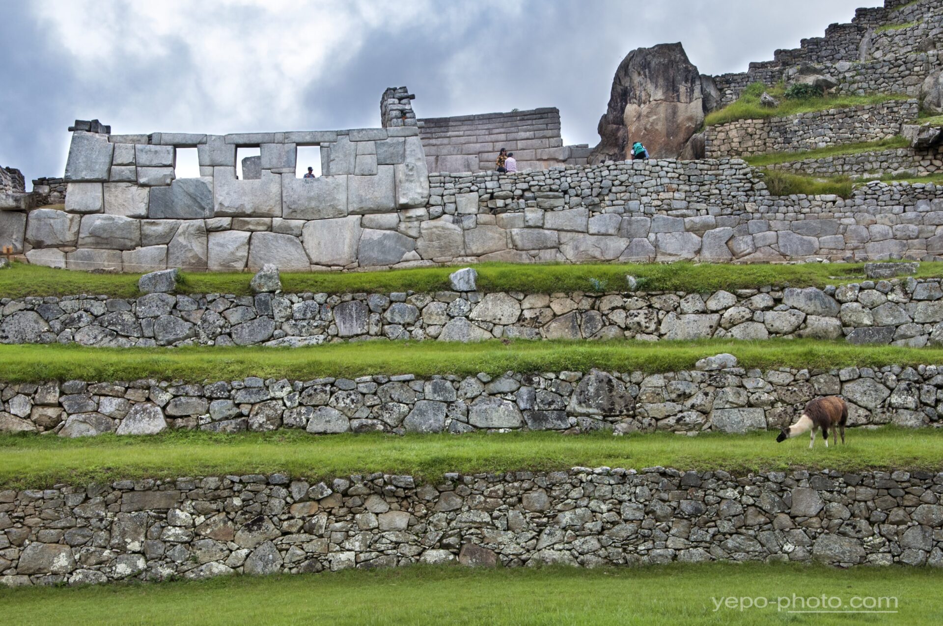
A fifteen minute walk takes us to the main square of the amazing Choquequirao ruins, which cover an area bigger than Machu Picchu.
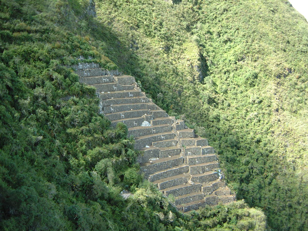
Perched on a hilltop 1,700m (5580ft) above the Apurimac, the location and views are awe-inspiring. If you have the energy, you can even go down to the famous white stone llamas laid into the rock.
Choquequirao is still a bit of a mystery and large areas still remain covered in the thick cloud forest. This site was not mentioned in the Spanish chronicles and although Hiram Bingham visited it before Machu Picchu he didn’t realise how important it was.
It is protected by its remote location and still receives very few visitors.
After a great day exploring we return to camp to relax and reflect on the day.
Day 4: Choquequirao to Maizal (B,L,D)
We set off early for the short climb to the pass, before descending for around 1400m (4600ft), past the recently discovered ruins of Pincha Unuyoc, to the Rio Blanco where you can soak your feet in the cool water.
But beware of the biting sandflies. Known as “Pumahuacachi”, their name means “makes the puma cry”. Refreshed, we climb steeply again, 1,200m (3900ft) to the wonderfully located campsite of Maizal, which sits at 3,000m (9840ft).
This is arguably the toughest day of the trip but if you are fit and determined, you’ll succeed. And the cold beer on arrival will taste even better.
Day 5: Maizal to Yanama, drive to Lucmabamba (B,L,D)
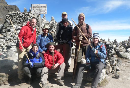
We leave camp behind and head up past old silver mines to the highest pass of the trip. Abra San Juan at 4,000m (13123ft) offers amazing views of the Cordillera Vilcabamba range. We then take a lovely, and at times steep, path down to the charming village of Yanama.
We are now at the road head and here we say goodbye to our muleteers. We begin our drive down through coffee plantations to the small village of Lucmabamba and our final camping spot.
Day 6: Lucmabamba - Llactapata - Machu Picchu Pueble (B,L, D)
Our final day of hiking!
We take a fabulous royal Inca trail up through lush plantations of coffee and tropical fruit, into untouched cloud forest. As the path approaches the ridge, old Inca walls appear out of the forest and we enter the ruins of Llactapata. Hiram Bingham also got here, but drew a map that was so bad, neither he nor anyone else could find the ruins again for 80 years! It wasn’t until the mid-1990’s that they were found once more, covered by thick jungle vines.
A few metres on we will have a magnificent, and rarely seen, view across to Machu Picchu. After some time to sit and contemplate the vista, we go steeply downhill to the Urubamba valley and the hydroelectric plant train station. From here we have the option to either take the short but scenic train ride, or hike two to three hours along the rail-track to the bustling town of Machu Picchu Pueblo and the hotel where we will spend the night.
Day 7: Tour of Machu Picchu (B ,L)
First thing in the morning we head up the hill to the fabled “Lost City of the Incas – Machu Picchu” for a fully guided tour of the residential, religious and agricultural sectors.
Machu Picchu entrance times are set hourly and only valid for four hours. We usually aim for mid-morning entrance. This avoids the sunrise rush and ensures you have a good breakfast before the long day ahead.
In the afternoon, we board the train for an interesting ride along the Sacred Valley of the Incas. Here our waiting transfer whisks us back to Cusco and our hotel. Then, if you have the energy, you can explore Cusco’s many excellent restaurants and bars.
IMPORTANT – Machu Picchu and Huayna Picchu Mountain permits.
If you wish to climb Huayna Picchu or Machu Picchu Mountain, permits have to be purchased.
For a short description of the walks, please see below.
Huayna Picchu Mountain
A steep one-hour climb (360m above the main Machu Picchu ruins), much of which is up Inca stairs. The climb involves scrambling and requires a good head for heights as there are some drops and a set of steep stairs – with no railing.
The views from above are wonderful and certainly reward those who tackle it. It’s worth visiting the Temple of the Moon on the west side of Huayna Picchu mountain, 400m below the summit. There is some high quality Inca stone work inside a cave, once a sacred place. Climbing Huayna Picchu is popular and permits usually sell out, which means there will be 200 climbers for each time slot given.
Do not attempt this climb if you are concerned about suffering from vertigo.
Machu Picchu Mountain
Just south of the site, and overlooking it, is a 650m climb up a well made Inca pathway (approx 1.5 hrs to top, 1 hr down) to the top of Machu Picchu Mountain.
There are some Inca constructions on the top that were probably for religious ceremonies, given the prominent position of the mountain. The hike takes you through lush forest, keeping a look out for interesting birds, flowers and snakes sunbathing on the path.
The views over the site a great and you can see the iconic Huayna Picchu as the backdrop to Machu Picchu, as well as the mountains beyond. It is attracting more and more people as an alternative to Huayna Picchu but is still a lot quieter.
Prices From $3,101 / £2,521 per person
What's Included?
English-speaking guide, cook, camp assistants, snacks & water, breakfast (except day 1), lunch, dinner, Choquequirao Trekking permit, emergency horse, mule support, camping equipment, camping fees, sleeping bag, liner & pillow ,trekking poles, Machu Picchu entrance fee, train to and from Machu Picchu, Day 6:night at Hotel El MaPi by Inkaterra (Superior Deluxe), bus to and from Machu Picchu, all transport, guide’s train tickets.
What's Not Included?
National or International flights, personal belongings, Cusco hotel on Day 7, entrance to Huayna Picchu & Machu Picchu mountains, personal expenses, travel insurance and tips,
Accommodation
Camping with dining tent and toilet tent, plus one night in Hotel El MaPi by Inkaterra (Superior Deluxe) in Aguas Calientes
Tour Staff
All guides are certified, bilingual, English-speaking guides who have worked with us for many years.
Cooks, mule drivers and additional staff are all from the local communities and we have worked with them for a long time.
Meals
Vegetarians and many other dietary requirements are catered for without problems. Please let us know in advance of any requirements you have.
You wake early, usually around 07.00. Breakfast is served in a dining tent, and consists of hot drinks, porridge, toast, jams and bread, and your guide will explain the day’s trekking plans.
Lunch is usually around 13.00 and can feature soups, meats, salads and fish, with vegetarian options and hot drinks too.
The campsites are comfortable and around 17.00 hot drinks, popcorn and other snacks are served to help you recover energy.
Dinner is served around 19.30, and will feature pasta, mashed potatoes, meat, fish or vegetarian options, followed by hot drinks and a pudding.
Activity Level
Although this trek starts at (relatively) lower altitude than others we offer, it is a strenuous trek. Climbs are long and steep.
Those with no previous trekking experience can trek this extended Choquequirao trek, but previous experience of hiking is beneficial.
The trip is open to anyone with a positive attitude who wants to walk in a stunning and remote part of Peru’s Andes, but please remember that this is a tough trek. It can get very hot in the Apurimac canyon. There are support mules if needed.
You hike 5-7 hours a day for a week, over rugged mountain trails at elevation and with some long ascents and descents.
Pre-trip preparation should include challenging cardiovascular exercise (including regular hikes on varied terrain) and a healthy, balanced diet.
Well-worn hiking boots and additional acclimatisation nights in Cusco (3-4) before the trek are both highly recommended.
All guests are encouraged to hike at their own pace, taking breaks whenever needed, to ensure a successful and enjoyable trek for all.
Most people go to bed fairly early after a long day trekking, to recover energy for the morning.
Practical Information
Introduction to Peru
Peru is the perfect holiday destination for adventure travellers that want an amazing variety of activity, geography and cultural travel experiences.
The breadth of travel experiences in Peru is breathtaking – from trekking in the Andes to Machu Picchu to the tropical jungle of the Amazon, and plenty in between.
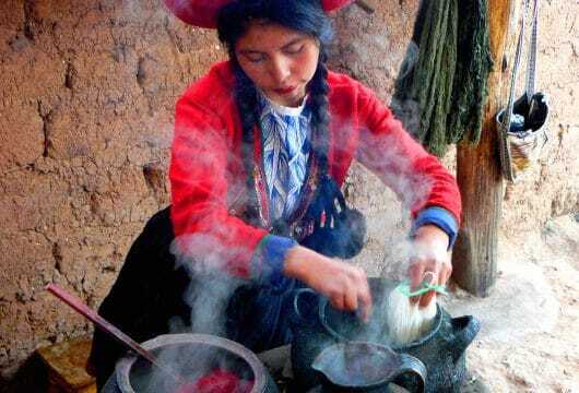
The people of Peru make it a special destination too, with its colourful and traditional street life and friendly locals.
Geography of Peru
Peru is made up of 3 distinct geographical areas: the coast, the mountains and the jungle.
The costa or coastal region is a narrow ribbon of desert 2,250 km long, crossed by fertile river valleys flowing from the Andes. It takes up 11% of the country and holds more than 40% of the population.
The cold Humboldt current gives rise to a blanket of mist – the garua – which hangs above coastal cities like the capital Lima from May to November.
Heading east, you’re soon climbing above the garua and into the Andes. The sierra, or mountainous region, covers some 25% of Peru’s territory and contains 50% of the population. The sierra inhabitants are mainly Indigenous or Mestizo, and many still speak Quechua or Aymara.
The sierra contains dozens of 6,000-metre snow peaks and volcanoes, including Huascaran (6,768m) the highest mountain in the tropics. The deep valley basins contain most of the towns and arable land; the terracing and canal systems of the Incas and pre-Incas are often still used today.
The eastern Andes are heavily forested up to 3,350m and sweep down into the Amazon Basin.
Peru’s selva or jungle makes up almost two thirds of the country’s area, but holds only about 6% of the population: the only towns with significant populations are Iquitos and Pucallpa.
Kit list
Good kit is vital for every trip.
Book with Andean Trails and get 15% off Páramo’s fantastic ethical and high performance outdoor gear.
Overview
When planning for the varied climatic conditions encountered, layering is the most practical and versatile clothing system. It’s worth remembering that our clothing keeps us warm by retaining and isolating the heat we ourselves create.
To best maintain body heat, several layers of lightweight, warm and quick-drying clothing are far more efficient than one or two thick layers. Layers should have the following qualities:
- Breathability (able to wick away the humidity produced by sweat):
- Isolation (able to keep in the warm air our body produces); and
- Impermeability (able to impede the passing of wind and water).
First (base) layer: This layer wicks the sweat away from our skin, thus helping keep the body dry and warm. To this end, synthetic fabrics such as polypropylene should be used.
Mid layers: These isolating layers should also be synthetic (e.g. the known polar linings such as polartec or windblock, which are light and insulate twice as well as wool). Very important layers for retaining body heat.
Outer layer / shell: Finally, the vital layer which protects us from climatic adversities. A breathable, wind-proof and waterproof anorak, such as Goretex.
Give plenty of thought to kit selection, and try to keep weight down.
We also carry an extensive first aid kit & oxygen on all trips, but these are generally for emergencies only.
Below is a more detailed kit list.
Detailed kit list
- 2 pairs synthetic inner socks (e.g. polypropylene, thermastat, coolmax) and 2 pairs thick loop-stitch/wool socks for cold.
- Trekking boots – should be well broken-in, waterproof and provide good ankle support.
- Trainers/sandals for city-wear, evenings at lower camps & river crossings.
- Base layer leggings (1 pair).
- Thick fleece leggings (or salopettes) (1 pair).
- Goretex-type over-trousers (or salopettes) (1 pair).
- Trekking trousers (2 pairs).
- Shorts – wear sparingly in early stages at altitude, as sun burns.
- Thermal base layer shirts (2).
- Microfleece mid-layer shirt (1).
- Shirt/t-shirt 1 or 2 for lower altitudes. Long-sleeved, collared shirt protects against sun
- Fleece jacket or similar (1).
- Warm jacket (down or synthetic). For camp and upper slopes.
- Waterproof Goretex-type jacket.
- Broad-brimmed sunhat, essential.
- Warm hat, fleece or wool. (N.B. Up to 30% of body heat can be lost through the head).
- Sunglasses with UV filter.
- Scarf for cold.
- Bandanna – to protect neck from strong sun.
- Light inner gloves
- Warm gloves, e.g. fleece, and outer waterproof gloves or mittens (1 pair)
- Mittens allow you to keep the fingers together, and better conserve heat (though they also make it difficult to perform certain tasks).
- Daypack (at least 30 litres). Comfortable and with waterproof lining or cover.
- Large rucksack or suitcase.
- Pair of telescopic trekking poles (can be rented).
- Duffel bag or large rucksack for extra clothing, carried by horse/mule/porter while you are trekking.
- Sleeping bag (3-4 season, can be rented).
- Water bottle (2 litres approx.) & purification tablets.
- Personal first-aid kit to include: painkillers, plasters (band-aids), moleskin, anti-biotic cream, general antibiotics (ask your GP), after-bite (tiger balm), anti-diarrhoea tablets, throat lozenges, re-hydration salts & personal medication.
- Insect repellent.
- Towel & wash-kit.
- Wet Wipes/antiseptic hand-wash cream.
- Toilet paper (1)
- Sunscreen (factor 30+) and lip salve.
- Head-lamp (plus spare bulb and batteries).
- Penknife.
- Travel alarm clock.
- Plastic bags – ‘Zip-loc’ & tough bin liners.
- Camera and film / memory cards (take at least twice the amount you think you will need!). Print & slide film is available locally. Polarising filter is recommended for SLR cameras.
- Book, e-book, mp3 player/ipod or other for free time.
- Binoculars.
- Spanish/English phrasebook.
- Extra snacks i.e. cereal bars or favourite chocolate bars.
All other non-personal trekking camping gear e.g. tents, cutlery etc is provided.
Miscellaneous others
- Money belt.
- Passport.
- U.S. dollars cash, mixed-denomination notes, undamaged and unmarked.
- ATM cash/credit card.
- Any inoculation certificates.
- Personal & medical insurance certificates.
- Presents e.g. Postcards from home.
- Comfortable clothes for travel, smart clothes for night life.
Fitness - hard treks
In order to get the most out of a trek we classify as ‘hard‘, you should be in great physical condition and used to trekking, camping and heavy carries.
It is not easy to grade the fitness level required for any trek, since it is a subjective matter.
However, for treks classified as hard, expect to trek 7+ hours per day carrying a heavy back-pack (15-20kg), with several long ascents and descents.
Altitude
Being at altitude, especially in the tropics, is usually a pleasure as it isn’t so hot, there are few insects and the air is clear.
However, when gaining altitude, air pressure drops and the amount of oxygen reaching the lungs is reduced. Although we build plenty of acclimatisation time into our itineraries, certain ill-effects are possible. Nevertheless, all of these can be minimised or prevented if care is taken.
On reaching heights above 2,500m (approx. 8,200 ft), especially when ascent has been straight from sea level, heart pounding, mild headache and shortness of breath are normal, especially on exertion.
Acute mountain sickness (AMS) is a syndrome known locally as soroche, whose symptoms can include of bad headache, dizziness and nausea).
To avoid AMS, you should:
- Rest for a few hours on arrival at altitude and take it easy for the first couple of days. Note: you may feel fine on arrival and tempted to exert yourself as normal. Don’t be fooled: you might be benefiting from oxygen brought in your blood from sea level.
- Drink plenty of water to avoid dehydration (altitude is a diuretic). Coca tea (mate de coca) helps alleviate symptoms.
- Eat light meals, with high carbohydrate and low fat and protein content. Dine early, allowing digestion time pre-sleep.
- Avoid over-exposure to the strong highland sun (UV rays are very powerful) – especially in the early stages – making sure you wear a broad brimmed sunhat. Apply lip-salve to prevent chapped lips.
- Avoid or minimise consumption of cigarettes and alcohol. Avoid sleeping pills.
- If you do get AMS: Rest, take non-aspirin painkillers (for headache) and coca tea. Symptoms should subside after a day or two.
- Pregnant women, people with a history of heart, lung, kidney or blood disease or blood pressure problems, should consult their doctor before traveling to high altitude.
Peru Festivals
February
Festival: Carnaval
Games throwing water, flour as well as dance and music.
Location: Highlands and some coastal areas.
Festival: Fiesta de La Candelaria
Culture, music and dancing
Location: Puno
March
Festival: Fiesta de La Vendimia
Wine harvest festival
Location: Ica
24 June
Festival: Inti Raymi
Culture, music and dancing
Location: Cusco
28/29 July
Festival: Independencia
Independence day – celebration of Peruvian culture – various activities
Location: Country wide
Responsible Travel - our ethos
Andean Trails believes in Responsible Travel and actively supports several community projects.
Please see Our Advice and Our Ethos for more, and learn about the Projects We Support.
We operate the Inca Trail, our treks and tours with local firms.
We make sure that on our tours and Inca Trail we employ local staff, who are paid fair wages.
With the Inca Trail, We provide free life insurance to all of our porters. Tented accommodation and meals are provided for all trekking staff as well as foam mats, sleeping bags and rain ponchos. We have also provided the staff with trekking shoes. We ensure our porters carry a maximum of only 20kg. We offer them backpacks and they generally use back supports.
Clean burning fuel is used to cook the meals on the Inca Trail and porters carry gas stoves and butane bottles. We use biodegradable detergents when washing the cooking and eating utensils. If any part of our tour or trek is operated by another company, we try to ensure that high standards are maintained.
Our additional support helps the Huchuy Yachaq project which supports children and families in one of the poorest communities in the district of Cusco.
Responsible Travel - travel tips
Responsible Tourism – Code of Conduct:
- Find out about your destination – take some time before you go to read about the cultural, social and political background of the place and people you are visiting.
- Go equipped with basic words and phrases in the local language – this may open up opportunities for you to meet people who live there.
- Buy locally-made goods and use locally-provided services wherever possible – your support is often vital to local people.
- Pay a fair price for the goods or services you buy – if you haggle for the lowest price your bargain may be at someone else’s expense.
- Be sensitive to the local culture – dress and act in a way that respects local beliefs and customs, particularly at religious sites.
- Don’t undermine the local economic systems – we recommend you don’t give gifts, especially sweets as there are few dentists in the Andes. Much better to spend time chatting, playing and showing postcards of home. If you would like to donate clothes and shoes etc we are more than happy to do so through the relevant channels. Your tour leader can do this for you and some of the projects we support can be visited.
- Ask permission before taking photographs of individuals or of people’s homes – and remember that you may be expected to pay for the privilege.
- Avoid conspicuous displays of wealth – this can accentuate the gap between rich and poor and distance you from the cultures you came to experience.
- Make no promises to local people that you can’t keep – be realistic about what you will do when you return home.
- Minimise your environmental impact – keep to footpaths and marked routes, don’t remove any of the natural habitat and reduce the packaging you bring.
- Don’t pollute local water courses- use biodegradable products, and wash basins.
- Slow down and enjoy the differences – you’ll be back with the familiar soon enough.
Health and Safety
A full Health and Safety document will be sent to you at the time of booking and before you travel.
You can also read it on our website, or contact us for more information.
And lastly...
Many of our tours travel through remote areas.
We believe our clients should be aware that the remoteness of some of our tours so very special could also cause certain problems.
Thus, whilst we endeavour to minimise the chances of anything unexpected happening, it has to be noted that no itinerary can or should be rigidly adhered to.
This is the very nature of adventure travel and we expect our clients to be prepared for delays and slight alterations in our programmed events.
Also, shared tours may include travellers from all over the world whose native language is not English.
Available Dates
06th Jul 2025 - From $3101 / £2521.113
Guide price, per person, shared tent basisSingle room supplement applies
Private treks available - please enquire
03rd Aug 2025 - From $3101 / £2521.113
Guide price, per person, shared tent basisSingle room supplement applies
Private treks available - please enquire
07th Sep 2025 - From $3101 / £2521.113
Guide price, per person, shared tent basisSingle room supplement applies
Private treks available - please enquire
05th Oct 2025 - From $3101 / £2521.113
Guide price, per person, shared tent basisSingle room supplement applies
Private treks available - please enquire
02nd Nov 2025 - From $3101 / £2521.113
Guide price, per person, shared tent basisSingle room supplement applies
Private treks available - please enquire


Dates & Prices
Select an available date to view pricing and information for that particular trip.
Guide price, per person, shared tent basis
Single room supplement applies
Private treks available - please enquire
Can’t find what you’re looking for? Get in Touch
+44 (0)131 378 5593
+44 (0)131 554 6025
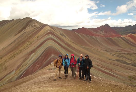
Suggested Trips
4-Day Inca Trail Hike To Machu Picchu, Peru
https://www.andeantrails.co.uk/tour/4-day-inca-trail-machu-picchu/ a Group Tour
  a Tailor Made Tour
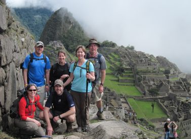
Prices From $1,175 / £955 per person
Dates: From March 2025 to January 2026
Duration: 4
Capacity: 16 people
Inca trail to Machu Picchu We offer daily Inca Trail trek departures with porters who help to carry your personal and all communal kit on the trek to Machu Picchu. Your days are spent hiking through various eco-systems, surrounded by mountain scenery unchanged for centuries. Every step takes you closer…Ausangate Camping Trek
https://www.andeantrails.co.uk/tour/ausangate-5-day-trek/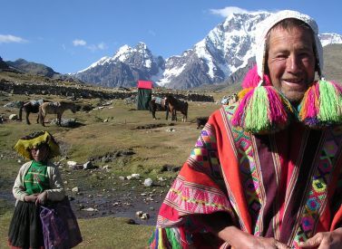
Prices From $780 / £634 per person
Dates: From March 2025 to October 2025
Duration: 5
Capacity: 12 people
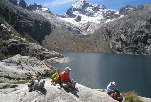
More on Ausangate 5-day trek You should be fully acclimatised before starting to walk as we will be camping in Altiplano well over 4,000m/13,123ft and crossing several passes at around 5,000m/16,404ft. Our backdrop of snow-capped peaks and spectacular scenery accompanies us around the mystical Mount Ausangate (6,350m/20,505ft). We walk among…Choquequirao 5-day Trek To Inca Ruins
https://www.andeantrails.co.uk/tour/choquequirao-trek/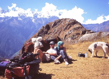
Prices From $726 / £590 per person
Duration: 5
Capacity: 12 people
More on Choquequirao trek The dramatically situated ruins, according to the historians, were the refuge for the last Inca rebels of Vilcabamba. To reach them, we pass through a range of vegetation types and temperatures, with a variety of views to match. Because the only way to get to the…Moon Temple Trek To Machu Picchu, Peru
https://www.andeantrails.co.uk/tour/moon-temple-trek/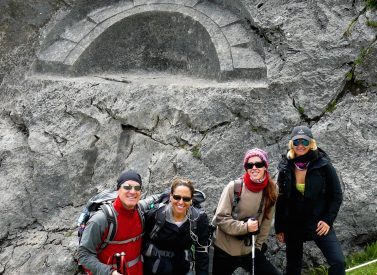
Prices From $1,800 / £1,463 per person
Dates: From March 2025 to January 2026
Duration: 5
Capacity: 16 people
More on Moon Temple trek After visiting the traditional village of Chincheros – with a tour of its impressive Inca terraces and carved boulders – we pass through the rich farming plain of Anta. At Anta, we stop to explore the beautiful Inca temple called Quillarumiyoc – the Moon Temple.…