Guide to the Best Hiking Trails and Walks in and around Bariloche.
![]() by Tom Shearman on 7th November, 2021
by Tom Shearman on 7th November, 2021
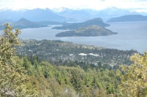
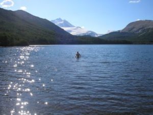
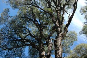
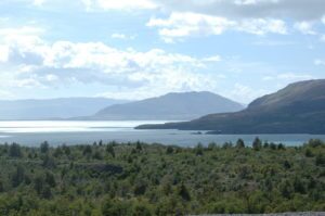
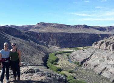
Bariloche is one of Patagonia’s most enchanting spots, nestled on Lake Nahuel Huapi and surrounded by glacial lakes, mountains, and beautiful forests. It is this landscape that makes Bariloche’s hiking trails so good.
Also known as San Carlos de Bariloche, this town offers hikers access to some of the best trails in Argentina’s Lake District. At its heart is Argentina’s oldest national park, Nahuel Huapi National Park. Glaciers, snow-capped mountains and pine forests await trekkers and there are no high altitude worries.
Bariloche’s accessibility is a big draw, too. It is situated in the mid-west of Argentina, close to the border with Chile. Arrival is by flights or long-distance buses, including from Puerto Madryn or Neuquén in Chile.
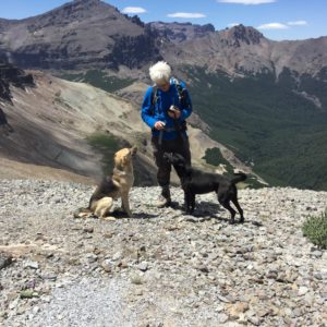
The wilderness and landscapes that sweep through this part of Argentina’s Lake District appeal to all levels of hikers. Many lower-level trails are open year-round. Most paths are available from October to April/May, with January-March being the best trekking season.
Read more in our guide to the best Bariloche hiking trails, from family-friendly short walks to challenging day hikes and longer routes. Drop us a line if you need us to book up guides and logistics.
Whichever trek you choose, you won’t fail to be won over by Bariloche’s enduring beauty.
Bariloche Hiking Trails: Short Walks Nearby
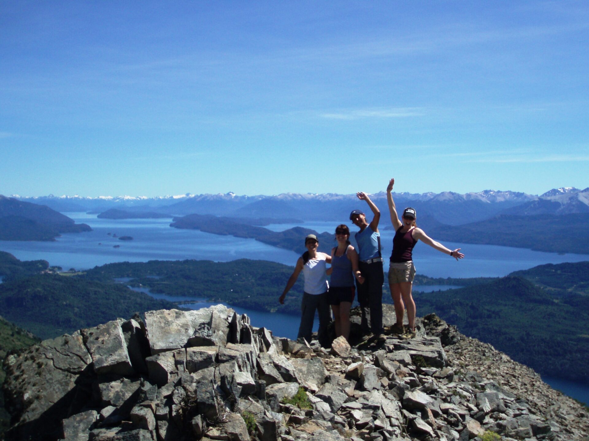
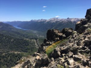
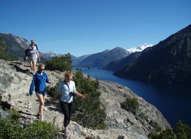
Circuito Chico
Circuito Chico translates as the ‘small circuit’, but its name doesn’t reflect what it offers — stunning lookouts over crystal-clear lakes and forests on the Llao Llao peninsula.
Many people rate it as the best day hike in Bariloche, which is why you will most likely encounter other hikers and even some cyclists. The entire loop takes 4-5 hours in total on predominantly even terrain with a few uphill pulls.
Time: 4-5 hours (total)
Note: There is the option to hike up Cerro Llao Llao, too. (1,025 /3,363 ft). Few make this side trip, so you may have the place to yourself, with views to Cerro Lopez, Lago Moreno, Cerro Capilla, Brazo Tristeza and Lago Nahuel Huapi. The climb adds about two hours to the walk, around 3.5 miles/6 kilometres.
Los Duendes Waterfall, Lago Gutiérrez
Enchanting forests and some small cascading waterfalls await people on this family-friendly walk. You follow the same route in and out as you walk along the banks of Lago Gutiérrez, just south of Bariloche.
There are lake views to enjoy en route to the waterfalls. The path and terrain are suitable for most people. Do take good walking shoes as some areas can be slippery.
Time: 1.5 hours (total)
Ascent: 100m / 330ft up to a max. height of 868m / 2,487ft
Distance: 1.2km (total) or 3km if you start in Villa Los Coihues.
Sendero de Los Arrayanes
The Sendero de Los Arrayanes is a lovely, short route ideal for families or anyone looking for a gentle stroll.
You start on the Circuito Chico road and walk into a forest full of arrayanes — myrtle trees. The 3km walk offers forest, views of Lago Moreno, and a relaxing way to enjoy Bariloche’s beautiful forests.
Time: 2 hours (total)
Ascent: 35m / 115ft up to a max. height of 820m / 2,690ft
Distance: 3km
Cerro Campanario
Cerro Campanario features a steep hiking trail that rewards you with some of the best, if not the best, views of the Bariloche area. If you want to avoid that stiff 30 to 45-minute ascent, a chairlift offers a more leisurely arrival.
Lots of people visit the panoramic lookout so expect to meet others. There is a café at the top, too. Those that visit late in the day/evening will encounter fewer people. The 360-degree views are superb at any time.
Time: 1 hour (total) + viewing time
Ascent: 240m / 787ft up to a max. height of 1,080m / 3,543ft
Distance: 1km (total)
Bahía López to Mirador Brazo Tristeza
This walk features a gentle climb through a forest to a viewpoint overlooking the Tristeza section of Lago Nahuel Huapi and Cerro Capilla mountain (1,958m/6,434ft).
The lookout is popular, so while suitable for children, do keep an eye on them at the viewpoint; there are various rocky outcrops.
Time: 1.5 hours (total)
Ascent: 100m / 330ft up to a max. height of 868m / 2,487ft
Distance: 1.4km (total)
Longer and Multi-day Walks: Bariloche Hiking Trails
Refugio Frey
Refugio Frey is one of Bariloche’s most accessible and popular hikes. Why? A rocky landscape starts with beautiful views of Cerro Catedral, and most of the walk is on flat terrain. You’ll pass forests, rivers, and streams as well as soaring peaks.
The walk takes about four hours to Refugio Frey, where you can overnight or return the same day to Bariloche. If you want a two-day hike, stay at Frey and walk to Refugio Jakob (six hours more).
Time: 4-5 hours (total)
Ascent: 700m / 2,295ft up to a max. height of 1,748m / 5,735ft
Distance: 9.5km/5.9 miles
Laguna Jacob
Laguna Jacob enjoys a privileged position at the end of a valley surrounded by Cerro Navidad (2,093m/6,867ft), Cerro Reyes (2,090m/6,857ft), and Cerro Cuernos del Diablo.
As a day walk, it’s a long one to go there and back in a day. A gentle, forested opening see you follow a river to a bridge. Once over the bridge, the path starts to rise as you climb towards the lake, with its mountain views.
You can stay overnight at Refugio San Martin/Refugio Jacob, which sits at the trail’s end or return by the same route. You can also traverse on to Laguna Negra, albeit this is recommended with a guide.
Time: 5 hours (one way)
Ascent: 800m / 2,625ft up to a max. height of 1,580m / 5,184ft
Distance: 13km (one way) 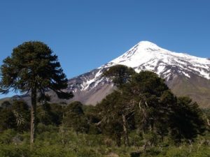
Paso de las Nubes
This two-day hike, called the ‘Cloud Pass’, is a challenging 23.3 kilometre (14.5 miles) point-to-point trek. It gets its name from the clouds that creep over the mountains from the Chilean side.
Rio Frias and Lago Frias, which you cross by boat, are your companions in this genuinely remote trek. Waterfalls, snow-capped peaks, and trees abound.
South to north: Start at Pampa Linda and hike north to Puerto Blest, sleeping at the Agostino Rocca Hut (1,400m/4,593ft). A ferry takes you from Puerto Blest to Bariloche (check times, subject to weather conditions).
North to south: Catch the ferry to Puerto Blest and walk the opposite way to Pampa Linda.
Time: 2 days
High point: 1,430m/4,691ft
Distance: 24km/14.9 miles
Laguna Negra
The Laguna Negra walk offers lots of options; the primary route is a long, forested walk, passing a waterfall and a sharp climb at the end to the beautiful Laguna Negra.
You can make this into a two-day hike by overnighting at Refugio Laguna Negra, on the shore of the lake, before returning. Hikers looking for a long day out in the hills can return the same day. This trek is also known as the Refugio Manfredo Segre hike.
Time: 5 hours (one way)
Ascent: 800m / 2,625ft up to a max. height of 1,650m / 5,413ft
Distance: 14km (one way)
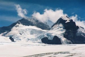
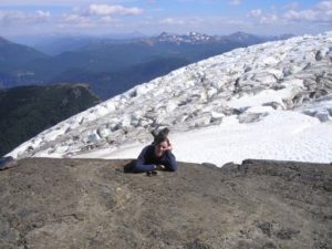
Cerro Tronador
Cerro Tronador — Thunder Mountain — marks the Argentina and Chile border. At 3,554m/11,600ft, it towers above the surrounding mountains. There are many attractions; spot trout in crystal clear waters, lakes, and kingfishers lower down, which give way to views and glaciers as you climb.
Hike to the Refugio Otto Meiling for views, or stay overnight (basic) and attempt the summit. The hike to the Refugio takes around 5 hours, and many people hike here, sleep, then hike out the next day and include a visit to the impressive waterfalls that flow from the Castaño Overa glacier.
For the peak baggers, the trek to the summit from the Refugio makes for a long, 9-10 hour day. Keep an eye on the Manso river, which changes colour during its descent from the summit.
The Cerro Tronador peak is for experienced hikers, and crampons will be required. A guide is recommended.
Time: 2-3 days
Height: Max. height of 3,554m/11,600ft
Distance: 24km/14.9 miles (Refugio only) | 40km/24.9 miles (summit)
Nahuel Huapi Traverse
The Nahuel Huapi traverse is a 5-day trek aimed at trekkers that want a challenging, multi-day hike around Bariloche. The route links many of the Bariloche hiking trails and refugios we’ve mentioned.
A classic traverse would encompass starting at Villa Catedral and walking to Refugio Grey for your first night’s stop. From here, head to Refugio Jakob, then on day 3, walk to Refugio Laguna Negra. The fourth day takes you to Refugio López for a final night before finishing your hike at Arroyo López.
Time: 5 days
Distance: 50km/31 miles
Find Out More About the Best Bariloche Hiking Trails
These are just some of the adventures that await you on Bariloche’s hiking trails. Cycling, kayaking, and horse riding, as well as fine dining, and more can also be arranged. Contact us for more.
Suggested Trips
Bariloche Multi-activity Tour
 a Tailor Made Tour
 What's a tailor made trip?
We put together a bespoke tour to fit your requirements.

Prices From $1,350 / £1,098 per person
Duration: 5
Capacity: 16 people
More on Bariloche multi-activity excursions and trips We can tailor the activities to your level and experience, so you make the most of your time in Bariloche. And after a great day of exploration, relax in your comfortable hotel, enjoy a stroll along the lake shore or choose a fine…Bolivia, Chile and Argentina Tour
a Tailor Made Tour What's a tailor made trip?
We put together a bespoke tour to fit your requirements.
Prices From $3,850 / £3,130 per person
Duration: 15
Capacity: 16 people
More on Bolivia, Chile and Argentina We start in Salta in northern Argentina. We explore this stunning part of the country, passing colourful cultures and rock formations including Purmamarca, a rainbow mountain of seven colours. Towns such as Humahuaca – with frequent street music – Tilcara, Uquía and Purmamarca thrive among…Fitz Roy M Trek, Argentina
 a Group Tour
 What's a group trip?
Join a small group of like-minded travellers on a guided trip.
a Tailor Made Tour What's a tailor made trip?
We put together a bespoke tour to fit your requirements.
Prices From $3,120 / £2,537 per person
Dates: From October 2024 to April 2025
Duration: 6
Capacity: 16 people
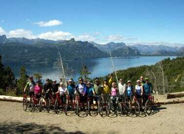
More on Fitz Roy M trek The Fitz Roy M walk — so-called for the M shape the trek follows — showcases the very best of Fitzroy National Park in Argentina, Patagonia. Our version of the Fitz Roy M trek includes Río Electrico, Laguna Torre and the beautiful Cerro Torre…Patagonia Lake District Cycling Tour: Chile & Argentina
a Group Tour What's a group trip?
Join a small group of like-minded travellers on a guided trip.
a Tailor Made Tour What's a tailor made trip?
We put together a bespoke tour to fit your requirements.

Prices From $5,300 / £4,309 per person
Dates: From November 2025 to January 2026
Duration: 12
Capacity: 16 people
More on Patagonia cycling tour The following day, we cross into Argentina and head to Villa La Angostura, before continuing to Bariloche, a town famous for its chocolate and Swiss-style architecture. From Bariloche, we cycle along the picturesque Ruta de las Siete Lagos to San Martín de los Andes. Our…Road trip, Ruta 40, Argentina Patagonia.
a Group Tour What's a group trip?
Join a small group of like-minded travellers on a guided trip.
a Tailor Made Tour What's a tailor made trip?
We put together a bespoke tour to fit your requirements.

Prices From $3,750 / £3,049 per person
Dates: From October 2024 to December 2025
Duration: 12
Capacity: 4 people
More on Route 40 Road Trip We visit Los Alerces National Park, home of the endangered alerce (Fitzroya cupressoides), 2nd longest living tree species. Here dense temperate forests give way to alpine meadows and high Andean peaks. We drive across the immense Patagonian steppe to visit the Sarmiento Petrified Forest…